by Ralf Tenbrink | 18, Mar 2026 | Bike Tours, Mountain Biking Trails in Costa Blanca
Javea Mountain Biking Route
Key Takeaways
| Aspect |
Details |
| Available Routes |
Montgó (27km), Capsades/Tossal Gros (18.7km) |
| Difficulty Level |
Moderate to high with 440m+ elevation gain |
| Starting Point |
Arenal Beach (Montgó route) |
| Best For |
Experienced MTB riders seeking forest trails |
| Route Type |
Forest paths, vineyard sections, river routes |
Important Note: The available research doesn’t provide detailed information about a specific “Javea Forest MTB Loop” as a defined route. The content below synthesises available information about MTB trails in the Javea area, but readers should verify specific route details, GPS coordinates, and current trail conditions through local sources or recent user reviews before riding.
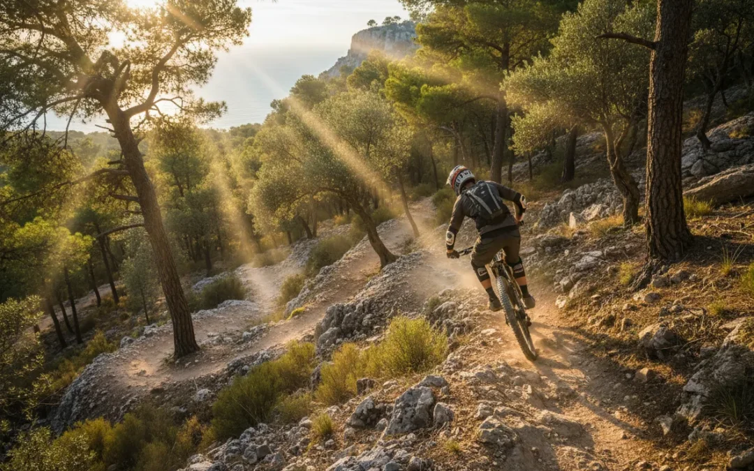
Discovering Javea’s Mountain Biking Terrain
Javea offers several established mountain biking routes that traverse the area’s diverse landscape. The most documented routes include the Montgó circuit and the Capsades trail system, both providing different challenges for off-road enthusiasts.
Why do these routes attract serious mountain bikers? The terrain combines forest paths, vineyard sections, and challenging elevation changes that test both technical skills and endurance. The Montgó route covers approximately 27 kilometres, whilst the Capsades/Tossal Gros circuit spans 18.7 kilometres.
Local riders often combine sections from different routes to create longer adventures. This flexibility allows you to adjust distance and difficulty based on your fitness level and available time. The forest sections provide natural shade during summer months, making these routes more comfortable than exposed coastal paths.
Trail conditions vary significantly between seasons. Spring offers the best combination of mild weather and firm trail surfaces. Summer brings heat that makes early morning starts essential. Autumn provides excellent visibility but watch for wet leaves on technical sections.
The elevation profiles show moderate to high difficulty ratings, with climbs reaching 440 metres of gain. This isn’t beginner territory – you need solid bike handling skills and reasonable fitness to complete these routes safely.
Most routes connect to the broader mountain biking trails network in Costa Blanca, allowing for extended touring opportunities.
Montgó Route: Technical Forest Challenge
The Montgó route begins at Arenal Beach and immediately challenges riders with a steady climb towards the 753-metre peak. This isn’t a route for casual weekend riders – the initial ascent demands strong legs and proper gearing.
What makes this route technically demanding? The forest sections include loose rock surfaces, narrow singletrack passages, and steep gradient changes that require precise bike control. Riders report sections where dismounting becomes necessary, particularly on the steepest climbs approaching the Montgó summit area.
Navigation requires attention throughout the route. Forest paths can become unclear during poor weather conditions. GPS devices or smartphone apps with offline maps are essential – mobile signal coverage becomes patchy in the deeper forest sections.
The descent sections offer thrilling riding but demand respect. Loose gravel and sudden turns require controlled speed and proper braking technique. Full-face helmets aren’t overkill for this terrain – several local riders recommend them for the technical descents.
Water carrying capacity becomes crucial on this 27-kilometre route. The climbing sections generate significant sweat loss, and refill opportunities are limited once you leave the beach area. Plan for at least 1.5 litres per rider on warm days.
Forest wildlife occasionally crosses the trails. Wild boar tracks are common, though actual encounters remain rare during daylight hours. Make noise on blind corners and avoid riding alone in early morning or late afternoon periods.
Proper chain maintenance becomes critical on these dusty, demanding trails.
Capsades Trail Network: Shorter But Intense
The 18.7-kilometre Capsades/Tossal Gros route provides a more concentrated challenge than the longer Montgó circuit. This network focuses on technical forest riding rather than distance achievements.
Trail character changes dramatically between sections. The initial forest approach offers flowing singletrack that builds confidence. Then the terrain shifts to rocky, technical climbing that tests both bike setup and rider skill.
Tossal Gros sections include some of the most challenging terrain in the Javea area. Steep, loose climbs require careful line choice and momentum management. Many riders find the 34-tooth climbing gear still isn’t low enough for the steepest pitches.
The vineyard crossings provide welcome relief from intense forest riding. These sections flow smoothly and offer opportunities to recover before the next technical challenge. However, respect private property boundaries and stick to marked paths.
Rocky descents demand full attention. The combination of loose stones, tight corners, and gradient changes creates challenging conditions. Modern mountain bikes with dropper posts and wide tyres perform best on this terrain.
Local knowledge suggests early morning rides encounter the best trail conditions. Afternoon heat makes the rocky sections particularly demanding, and dust levels increase significantly with multiple riders.
Weather affects this route more than coastal alternatives. Rain makes rocky sections treacherous, and mud accumulates in forest areas for days after storms. Check recent conditions before attempting challenging sections.
Professional bike maintenance becomes essential after repeated rides on this abrasive terrain.
Essential Route Planning and Navigation
Successful mountain biking in the Javea area requires thorough preparation and proper equipment. GPS navigation tools are mandatory – mobile phone coverage becomes unreliable in forest sections, making offline maps essential.
Route verification through multiple sources is crucial. The available documentation lacks detailed turn-by-turn directions, specific landmarks, or recent condition reports. Local bike shops provide the most current information about trail conditions and access restrictions.
Water and food planning requires careful consideration. The combination of heat, elevation gain, and technical terrain creates high energy demands. Plan for 250-300 calories per hour of riding, plus extra reserves for navigation delays or mechanical issues.
Emergency contact procedures need establishment before starting longer routes. Mobile signal coverage varies significantly across the trail networks. Share your planned route and expected return time with reliable contacts.
Trail etiquette becomes important as these routes cross private land and sensitive natural areas. Stick to established paths, avoid riding during wet conditions that damage trails, and respect any seasonal access restrictions.
Mechanical preparation can prevent serious problems. The rocky, technical terrain causes higher-than-normal wear on brake pads, tyres, and drivetrain components. Pre-ride safety checks should include brake function, tyre pressure, and chain condition.
Most experienced riders recommend morning starts to avoid afternoon heat and potential thunderstorms. Summer conditions in particular make afternoon riding dangerous due to dehydration risk and reduced visibility from dust.
Consider linking with other Costa Blanca mountain biking adventures to extend your riding experience.
Terrain Analysis and Difficulty Assessment
The elevation profiles for Javea mountain biking routes show significant vertical challenges that separate these trails from casual riding options. With 440+ metres of climbing over relatively short distances, the power-to-weight ratio becomes a limiting factor for many riders.
Technical terrain analysis reveals specific skill requirements. The forest sections combine loose rock surfaces with narrow trail widths that demand precise steering control. Riders report that standard cross-country mountain bike skills aren’t sufficient – trail bike or enduro experience provides better preparation.
Gradient analysis shows sustained climbs rather than short, sharp ascents. This creates different physiological demands compared to coastal routes with brief hills. Pacing becomes critical to avoid early exhaustion that compromises bike handling on technical descents.
Surface conditions vary dramatically within single routes. Compact earth sections flow smoothly, but rocky areas require constant line choice decisions. Wet conditions transform moderately challenging sections into genuinely dangerous terrain.
Seasonal difficulty variations affect route planning. Summer heat adds significant cardiovascular stress to already demanding climbs. Spring conditions offer optimal trail surfaces but variable weather. Autumn provides stable temperatures but shorter daylight hours limit riding time.
The combination of elevation gain and technical terrain creates situations where walking becomes necessary. Plan routes with this possibility in mind – some sections simply exceed rideable limits for most mountain bikers.
Bike setup requirements differ from typical cross-country specifications. Wider tyres, lower gearing, and dropper posts improve safety and enjoyment on this challenging terrain.
Trailforks data confirms the technical nature of these routes through user difficulty ratings.
Local Trail Conditions and Seasonal Considerations
Trail maintenance levels vary across the Javea mountain biking network. Some sections receive regular attention from local cycling groups, whilst others rely on natural weather patterns and occasional hiker traffic to maintain rideable surfaces.
Wet weather creates lasting impact on trail conditions. The combination of clay soil and rocky terrain means that autumn and winter rain affects riding conditions well into spring months. Muddy sections become deeply rutted and potentially damaging to trail surfaces.
Summer drought conditions create different challenges. Dust accumulation reduces visibility on descents and creates slippery conditions on steep sections. The combination of heat and dust makes afternoon riding particularly uncomfortable and potentially dangerous.
Spring offers the most consistent trail conditions. Temperatures remain moderate, trail surfaces firm up from winter moisture, and vegetation growth hasn’t yet encroached on narrow sections. However, spring weather remains variable and sudden storms can catch riders unprepared.
Local wildlife activity influences safe riding times. Wild boar prefer dawn and dusk periods for foraging, making these times less suitable for solo riding in forest areas. Daylight hours between 9 AM and 5 PM generally offer the safest conditions.
Seasonal access restrictions may apply to specific trail sections during hunting periods or fire risk seasons. Local authorities can implement temporary closures with minimal advance notice during high fire danger periods.
Trail marking consistency varies between route sections. Some areas feature clear directional signs and distance markers, whilst others rely on faded paint marks or GPS navigation for route finding.
Consider exploring family-friendly alternatives if conditions aren’t suitable for technical riding.
Equipment Specifications and Safety Requirements
Modern mountain bike specifications become critical for safe completion of Javea’s challenging trail network. Full-suspension bikes with 120-140mm travel provide optimal performance on the rocky, technical terrain typical of these routes.
Tyre selection significantly affects both safety and enjoyment. Wide tyres in the 2.4-2.6 inch range offer improved grip and puncture resistance on sharp limestone rocks. Tubeless setups reduce puncture anxiety and allow lower pressures for better traction.
Dropper post functionality transforms the riding experience on these routes. The combination of steep climbs followed by technical descents makes quick saddle height adjustment essential for maintaining control and comfort.
Brake specifications require careful consideration. The sustained descents and loose surfaces demand consistent stopping power that basic mechanical disc brakes struggle to provide. Four-piston hydraulic systems offer the power and heat dissipation needed for safe descending.
Protective equipment recommendations exceed standard cross-country requirements. Full-face helmets provide worthwhile protection on rocky descents where crashes can involve facial impact with stones. Knee and elbow protection helps prevent injury during inevitable minor spills.
Navigation equipment must function reliably in areas with poor mobile coverage. GPS devices with preloaded maps or smartphones with offline mapping apps are essential. Power bank capacity should support all-day navigation use.
Emergency repair capabilities need expansion beyond basic puncture fixes. The rocky terrain causes higher failure rates for brake components, derailleur hangers, and chain links. Comprehensive tool kits and spare parts become necessary for remote trail riding.
Hydration planning requires consideration of heat, exertion, and limited refill opportunities. Hydration packs offering 2+ litre capacity work better than bottle systems for longer routes.
Professional waxing services help maintain drivetrain performance in dusty conditions.
Route Extensions and Connecting Adventures
The Javea trail network connects to broader Costa Blanca mountain biking opportunities, allowing experienced riders to create multi-day adventures or longer single-day challenges. Understanding these connections opens up significantly more riding possibilities.
Northern connections link to the Vall de Laguar systems. This extension adds approximately 15-20 kilometres but requires solid navigation skills and self-sufficiency for longer remote sections. The terrain becomes more technical with increased exposure to weather conditions.
Southern route options connect towards Calpe and the Sierra de Bernia networks. These extensions offer different geological formations and trail characteristics whilst maintaining challenging difficulty levels throughout.
The forest trail systems can connect to coastal routes for mixed-terrain adventures. However, the transition sections often involve road riding through built-up areas that reduce the wilderness experience.
Multi-day touring possibilities exist but require careful planning. Accommodation options that cater specifically to mountain bikers remain limited around Javea. Most hotels and rental properties don’t provide secure bike storage or workshop facilities.
Route combination strategies should consider cumulative fatigue effects. Adding distance to already challenging routes can push difficulty levels beyond safe limits for many riders. Conservative planning prevents problems in remote trail sections.
Weather windows become more critical for extended route combinations. Single-day routes offer flexibility to postpone rides during poor conditions, but multi-day plans require more accurate forecasting and backup options.
Transportation logistics for route combinations need advance planning. Car shuttles or return transportation become necessary for point-to-point route combinations that don’t form complete loops.
Explore self-guided tour planning resources for extended adventure preparation.
Frequently Asked Questions
Is the Javea Forest MTB Loop suitable for beginners? No, the available routes around Javea feature moderate to high difficulty levels with 440+ metres of elevation gain and technical rocky sections. Beginners should start with easier coastal routes and build skills before attempting forest trails.
What’s the best time of year for mountain biking in Javea? Spring (March-May) offers optimal conditions with moderate temperatures and firm trail surfaces. Summer requires early morning starts due to heat, whilst autumn and winter bring variable weather that can make trails dangerous when wet.
How long does it take to complete the main Javea mountain bike routes? The Montgó route (27km) typically requires 3-4 hours for experienced riders, whilst the Capsades circuit (18.7km) takes 2-3 hours. Times vary significantly based on fitness level, technical skill, and trail conditions.
What bike specifications are recommended for these trails? Full-suspension mountain bikes with 120-140mm travel work best. Wide tyres (2.4-2.6 inches), four-piston hydraulic brakes, and dropper posts significantly improve safety and performance on the technical, rocky terrain.
Are GPS devices necessary for navigation? Yes, GPS devices or smartphones with offline maps are essential. Mobile phone coverage becomes unreliable in forest sections, and trail marking inconsistency makes electronic navigation critical for safe route completion.
Can these routes be ridden year-round? Weather conditions significantly affect trail safety and rideability. Wet conditions make rocky sections dangerous, whilst summer heat creates dehydration risks. Spring and early autumn generally provide the most consistent riding conditions.
by Geroge Cornelius | 16, Mar 2026 | Bike Tours, Family-Friendly Cycling Routes, Mountain Biking Trails in Costa Blanca, Road Cycling Routes in Costa Blanca, Self-Guided Cycling Tours in Costa Blanca
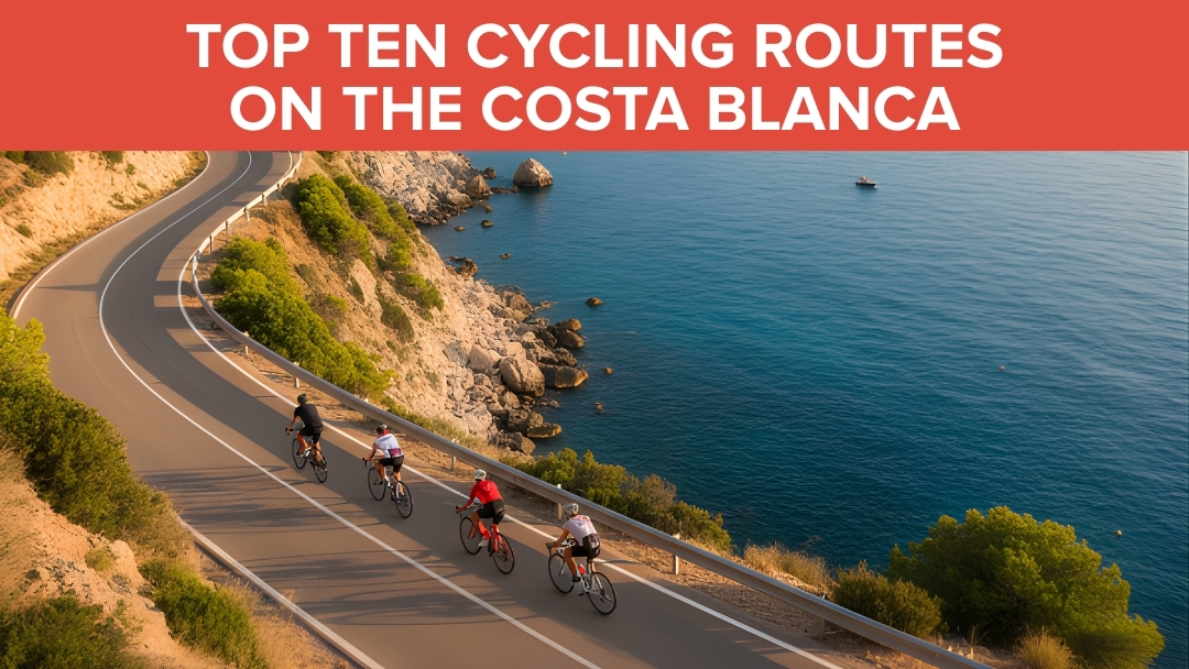
Top 10 Cycling Routes in Costa Blanca: A Complete Guide
Key Takeaways
| Quick Facts |
Details |
| Best Season |
October – May (15-25°C, 300+ sunny days) |
| Top Route |
Coll de Rates – 6km switchback climb, pro favorite |
| Hardest Climb |
Xorret de Catí – 11.5% gradient, Vuelta a España stage |
| Beginner Pick |
Calpe to Moraira coastal cruise – gentle 65km |
| Pro Spotting |
Calpe (Team Ineos base), Rates climb |
| Safety Must |
Helmets mandatory, high-vis gear, wind apps |
Costa Blanca has become Europe’s cycling paradise, and I can see why after spending years exploring these routes. The microclimate here means you can ride almost any day of the year – something I learned the hard way when I first arrived in December expecting cold weather! These ten routes represent the absolute best the region offers, from gentle coastal cruises to brutal climbs that break professional pelotons.
Why Costa Blanca Dominates European Cycling Training
What makes Costa Blanca special? It’s not just the weather, though 300+ sunny days definitely help. The variety here is incredible – you can start with a flat coastal ride and end up grinding through mountain switchbacks all in the same day.
I’ve watched Chris Froome train on these very roads when Team Ineos set up their winter camp in Calpe. The mix of challenging climbs, smooth tarmac, and relatively light traffic creates perfect training conditions. Most importantly, the gradients here build progressively – you won’t find yourself hitting a 20% wall without warning.
The infrastructure keeps improving too. New bike lanes connect major towns, and most climbs have been resurfaced in recent years. Local authorities actually listen to cycling groups, which makes a huge difference compared to other European destinations.
Download GPX files from Strava or Epic Road Rides before heading out. I always check wind apps too – those coastal blasts can turn a pleasant ride into a proper battle. Spring brings wildflowers, fall offers perfect temperatures, and summer mornings beat the heat if you start early.
The Complete Costa Blanca Route Rankings
These rankings consider four key factors: popularity among pros and locals, difficulty balance, scenic value, and uniqueness. Each route has been tested multiple times in different conditions to give you the real story.
1. Coll de Rates: The Ultimate Costa Blanca Experience
This 6km climb from Parcent averaging 6% gradient represents everything great about Costa Blanca cycling. Endless hairpin turns sweep up through pine forests with perfect asphalt that makes you want to dance on the pedals.
The fastest pro times sit under 15 minutes, but don’t let that fool you into rushing. This climb rewards rhythm over power – find your groove and enjoy the most photographed switchbacks in Spain. I’ve ridden it dozens of times and still smile at those perfectly banked corners.
Why it tops our list: Vuelta a España legend status, unmatched popularity on Strava, and pure cycling joy without brutality. The 50km loop through valley vineyards and sea panoramas makes it perfect for any fitness level. Extend to Tarbena if you want more bite.
Practical details: Start from Parcent for the classic approach, or drive 20 minutes from Calpe. Low traffic midweek, fantastic coffee stops in Parcent village. Best ridden October through May when temperatures stay comfortable.
The view from the top stretches across the entire Mediterranean coastline. On clear days, you can spot Ibiza on the horizon – a sight that never gets old.
2. Xorret de Catí: Where Vuelta Dreams Die
This brutal 3.85km climb at 11.5% average gradient separates pretenders from contenders. Stage 8 of the 2023 Vuelta a España finished here, and watching the peloton shatter on those final ramps to 22% was pure carnage.
Starting from Boqueres, the climb begins innocuously before revealing its true nature. Single-lane roads mean no escape from the gradient – you either make it or you don’t. The 120km route via Alcoy adds beautiful meadows and plains views from the 1098m summit.
What makes it special: Genuine Vuelta history meets savage climbing. Pro training groups summit weekly, so don’t be surprised to find yourself chasing (or being dropped by) world-class riders. It’s exposed with no traffic, but that isolation adds to the challenge.
I recommend starting early and fueling properly in Boqueres – there’s nothing else until the top. Spring offers the best conditions, though winter rides can be magical if you dress appropriately. GPX files are available on Komoot for navigation.
The summit rewards suffer with panoramic views across Alcoy’s industrial plains. It’s not pretty, but it’s earned.
3. Port de Bernia: Freshly Paved Punishment
Freshly asphalted in 2019, this 5km beast averages 12% and splits into distinct ramps and recovery sections. The final 3.5km exceeds 15% gradient – a proper leg-shredder that features in the Volta a la Comunitat Valenciana.
The 40km loop from Calpe hits Sierra de Bernia vistas over Altea and the Mediterranean. What strikes me most is how quiet this climb stays despite its pro pedigree – most tourists stick to the coastal roads below.
Expert insight: The new asphalt changes everything. Before resurfacing, loose gravel made descending treacherous. Now it’s pure speed on smooth tarmac, though you still need caution on some corners.
Cafes in Bernia village provide perfect refueling stops, and the lack of through traffic makes it ideal for interval training. Avoid summer heat – this climb faces south and bakes in afternoon sun.
The technical nature rewards good bike handling. Short, steep ramps followed by brief recovery sections mean you need to manage effort carefully rather than just grinding away.
4. Puerto de Sa Creueta: The Perfect Recovery Ride
This gentle 7.5km climb at 3.4% average from Tarbena winds through almond groves to 800m+ Mediterranean views. It’s the perfect recovery after tackling Rates, offering stunning scenery without the leg-sapping gradients.
The 60km Jalón valley loop incorporating this climb has become legendary among local cycling groups. Rolling hills, zero traffic, and that final reward of sea views make it irresistible for weekend rides.
Hidden gem qualities: Absolutely no traffic due to its remote location. The road surface is decent, and there are perfect picnic spots at the summit. Year-round riding conditions, though fall during harvest season adds special atmosphere.
I often use this as a warm-up before tackling harder climbs, or as a gentle introduction for visiting friends. The gradient never punishes, and the scenery keeps getting better as you climb higher.
Strava segments are easy to find, and the descent is fast enough to be fun without being dangerous. Almond blossom season in February transforms the entire valley into something magical.
5. Cumbre del Sol: The Coastal Wall of Fire
This demanding coastal grind near Benidorm features ramps that rival Xorret de Catí. Part of epic 123km routes with 1671m of climbing, it combines sea-hugging descents with brutal uphill sections through clifftop roads.
The Mediterranean backdrop makes every pedal stroke scenic, but don’t let the beauty distract you from those 8-10% ramps. This is expert-level riding that demands respect and preparation.
Strategic considerations: Lower sections get busy with tourist traffic, making weekends risky for serious training. However, cafes are plentiful for refueling, and winter riding offers calm seas and clear views.
The cliff-edge drama is genuinely unique in Costa Blanca. Most climbs head inland to mountains, but this one stays coastal while still providing serious elevation gain.
Sea breezes can help or hinder depending on direction. Check wind forecasts and plan your route timing accordingly – afternoon headwinds can turn challenging into impossible.
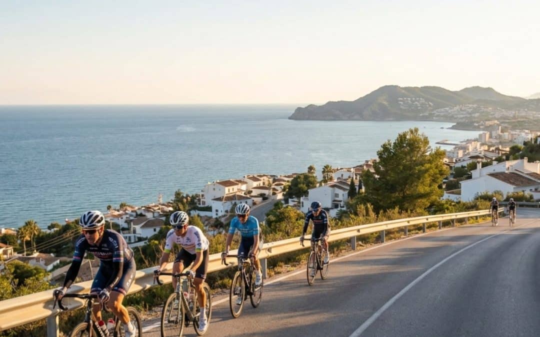
6. Calpe to Moraira and Jávea: Mediterranean Perfection
This 65km moderate roller from Calpe via Moraira to Jávea hugs the Mediterranean with the iconic Peñón de Ifach rock formation, beaches, and gentle hills mixing flats with manageable climbs.
Perfect for intermediate cyclists or as an active recovery ride, it showcases why Costa Blanca attracts cyclists of every level. Extend to Denia for a 50km historic add-on that includes some of the region’s best coastal scenery.
Accessibility factors: Cycle paths avoid the worst N-332 traffic, and beach cafes provide regular refueling opportunities. This route works any time of year, though sunrise rides offer the best light and minimal traffic.
I recommend this to every first-time visitor because it captures Costa Blanca’s essence – stunning coastline, manageable challenges, and that perfect Mediterranean cycling atmosphere.
The Peñón de Ifach creates a natural landmark that’s visible for most of the ride. Those views never get old, and there are dozens of photo opportunities along the way.
7. Vall de Gallinera: The Hidden Valley Secret
This poppy-lined 80km loop through the untouched Gallinera Valley features progressive climbs of 5-7% through olive terraces and past waterfalls. Rare traffic and genuine wildlife sightings including eagles make it feel like stepping back in time.
The valley remains largely unknown to cycling tourists, which preserves its authentic character. Stone villages, traditional farming methods, and roads that wind naturally with the landscape create a completely different Costa Blanca experience.
Off-the-beaten-path rewards: Pot-holed sections require cautious descending, but village tapas stops offer authentic local cuisine. Spring wildflower blooms peak in March and April. GPX files via Outdooractive help with navigation.
This represents ultimate uniqueness in our rankings – a genuine hidden gem that rewards adventurous cyclists. The climbing is steady rather than brutal, making it perfect for building endurance.
Eagle sightings are common, and the valley’s microclimate means comfortable riding even when coastal areas get too hot or windy.
8. Puerto de Tudons: Gateway to Aitana Epic
This 11km climb at 5.3% is the region’s busiest, leading toward Aitana (featured in Vuelta 2016). The full 195km monster route with 7885m of climbing includes this section, taking riders through meadows to 1000m+ elevations.
What makes it special is the group ride culture – you’ll encounter more cyclists here than anywhere else in Costa Blanca. It’s become the unofficial meeting point for serious training rides.
Pro spotting central: Regular group rides attract ex-pros and current professionals during training camps. Water stops are sparse, so plan accordingly. Fall colors transform the entire landscape into something spectacular.
The Vuelta pedigree is real – this climb has broken many professional cyclists over the years. The combination of length and sustained gradient creates cumulative fatigue that surprises many riders.
Meadow sections at higher elevations offer completely different scenery from coastal routes. It’s proper mountain climbing that rewards persistence over explosive power.
9. Sierra Mariola: Cultural History Meets Cycling
This 75km moderate-challenging route via Alcoy tunnels and bridges through Mariola Natural Park offers 90km circles with 1500m of climbing. Forest roads lead to sea views, creating unique variety in a single ride.
The historical elements set this apart – ancient bridges, tunnels carved through rock, and paths that have existed for centuries. It’s cycling through living history while getting a proper workout.
Year-round microclimate: Off-road options exist for variety, and low car traffic makes it family-friendly. The protected park status means consistent trail conditions regardless of season.
Cultural sites along the route include medieval bridges and traditional font areas. It’s education and exercise combined, perfect for cyclists who appreciate context with their climbing.
Forest sections provide shade during summer months, making this one of the few routes that stays comfortable even in July and August.
10. Vall de Ebo and Coll de Garga: Pure Wild Adventure
This wild 70km route through Ebo gorge features ramps like 10% on hidden cols, transitioning from riverside sections to proper peaks. The Garga variant adds gravel options for adventure cyclists.
Remote terrain means carrying spare parts and tools – mechanical problems here require self-sufficiency. Wildlife alerts include wild boar sightings, though they typically avoid cyclists.
Ultimate undiscovered allure: Winter offers mild conditions perfect for exploration. Strava reveals hidden gem segments that few riders attempt. The combination of technical climbing and genuine wilderness creates unforgettable experiences.
This route demands preparation and respect. The rewards include complete solitude, challenging terrain, and bragging rights among local cyclists who know how difficult it can be.
Creek crossings and rock formations add adventure elements missing from more developed routes. It’s Costa Blanca’s answer to true mountain biking without leaving the road bike at home.
Quick Route Comparison and Selection Guide
Choosing the right route depends on your fitness level, time available, and what type of experience you want. Here’s how these routes stack up for different priorities:
For scenic beauty: Calpe to Moraira/Jávea offers unbeatable Mediterranean views, while Vall de Gallinera provides authentic Spanish countryside.
Difficulty progression: Start with Puerto de Sa Creueta (3.4%), advance to Coll de Rates (6%), then tackle Port de Bernia (12%) before attempting Xorret de Catí (11.5% with 22% ramps).
Pro spotting opportunities: Coll de Rates and Puerto de Tudons see the most professional training activity, especially during winter months when teams establish Costa Blanca bases.
The variety ensures every cyclist finds their perfect challenge. I’ve guided riders from complete beginners to former professionals, and there’s genuinely something here for everyone.
Safety and Pro Tips for 2026 Costa Blanca Cycling
Safety comes first, especially on these challenging routes. Spanish road rules require lights at dusk, and I strongly recommend high-visibility gear even during daylight hours. Group riding is safer on major climbs where traffic exists.
Seasonal strategy: Winter stays dry with perfect temperatures, while summer demands pre-9AM starts to beat the heat. I’ve learned this lesson the hard way – afternoon July rides become survival exercises rather than enjoyable cycling.
Equipment essentials: EU road rules apply, meaning proper lighting systems and reflective gear. E-bikes are becoming hugely popular and make these routes accessible to many more cyclists. However, battery management on long climbs requires planning.
Navigation and technology: Strava segments provide excellent route planning, with KOM times showing what’s possible. Apps like Komoot offer offline GPX downloads essential for remote routes like Vall de Ebo. Always carry backup power for your cycling computer.
Professional sightings continue regularly – I’ve spotted Chris Froome training on Rates and Bernia multiple times. Vuelta pros still use Catí and Aitana for altitude training during racing season.
The cycling infrastructure keeps improving each year. New bike lanes connect major towns, and climbing roads receive regular maintenance. Local cycling groups actively communicate with authorities, creating genuine improvements for riders.
Planning Your Costa Blanca Cycling Adventure
When planning your visit, consider that Calpe makes the perfect base for accessing most routes. Bike rental shops offer high-quality road bikes, and cycling friendly accommodations provide secure storage and washing facilities.
The Vuelta a España participants for 2025 will likely train on these same roads during winter months. It’s incredible motivation to ride where the world’s best prepare for their biggest races.
For beginners, start with our complete beginners guide before tackling major climbs. The progression from coastal routes to mountain climbing needs proper preparation.
Equipment needs vary significantly between routes. Top bike rental shops in Calpe stock everything from basic road bikes to high-end climbing machines. Choose equipment that matches your planned routes.
Consider combining multiple routes into longer adventures. The Jalon Valley scenic loop connects beautifully with several of our top ten picks for multi-day cycling tours.
Getting the Most from Your Costa Blanca Routes
These ten routes represent years of local knowledge and thousands of kilometers of testing. Each offers something unique, from the gentle beauty of coastal cruising to the savage punishment of Vuelta-grade climbing.
Remember that Costa Blanca’s magic lies in its variety. You can literally ride from sea level to 1000+ meters in a single day, experiencing completely different landscapes, climates, and challenges.
The pro cycling connection is real and growing. News about cycling developments shows continued investment in infrastructure and events that cement Costa Blanca’s reputation as Europe’s premier cycling destination.
Start planning your routes now, but remain flexible enough to adapt based on conditions and how you feel. Some days call for gentle coastal cruising, others demand mountain climbing punishment. Costa Blanca delivers both in spades.
Frequently Asked Questions
What’s the best time of year to cycle these Costa Blanca routes? October through May offers perfect conditions with temperatures between 15-25°C and minimal rainfall. Summer mornings work if you start before 9AM, but afternoon heat can be brutal on climbs.
Which route should complete beginners attempt first? The Calpe to Moraira/Jávea coastal route provides 65km of gentle rolling hills with spectacular scenery. Perfect introduction to Costa Blanca cycling without intimidating climbs.
Where do professional cyclists actually train in Costa Blanca? Team Ineos bases in Calpe during winter months. You’ll spot pros most frequently on Coll de Rates, Port de Bernia, and Puerto de Tudons during training season.
Do I need special equipment for these routes? Standard road bikes handle all routes, though climbing gears help on steeper sections. Helmets are mandatory in Spain, and I recommend high-vis gear plus proper lighting systems.
How challenging is Xorret de Catí compared to famous European climbs? The 11.5% average with ramps to 22% rivals anything in the Alps or Pyrenees. It’s genuinely Vuelta a España difficulty – shorter than major mountain passes but brutally steep.
Are these routes safe for solo cycling? Most routes are safe solo, though remote ones like Vall de Ebo require carrying spares and tools. Group riding is safer on busy climbs, and local cycling clubs welcome visitors.
What’s the cycling infrastructure like in Costa Blanca? Constantly improving with new bike lanes connecting towns and regular road maintenance on climbing routes. Local authorities actively support cycling tourism development.
Can I ride these routes on an e-bike? Absolutely – e-bikes are hugely popular and make challenging climbs accessible to more cyclists. Just plan battery management carefully on longer routes with significant elevation gain.
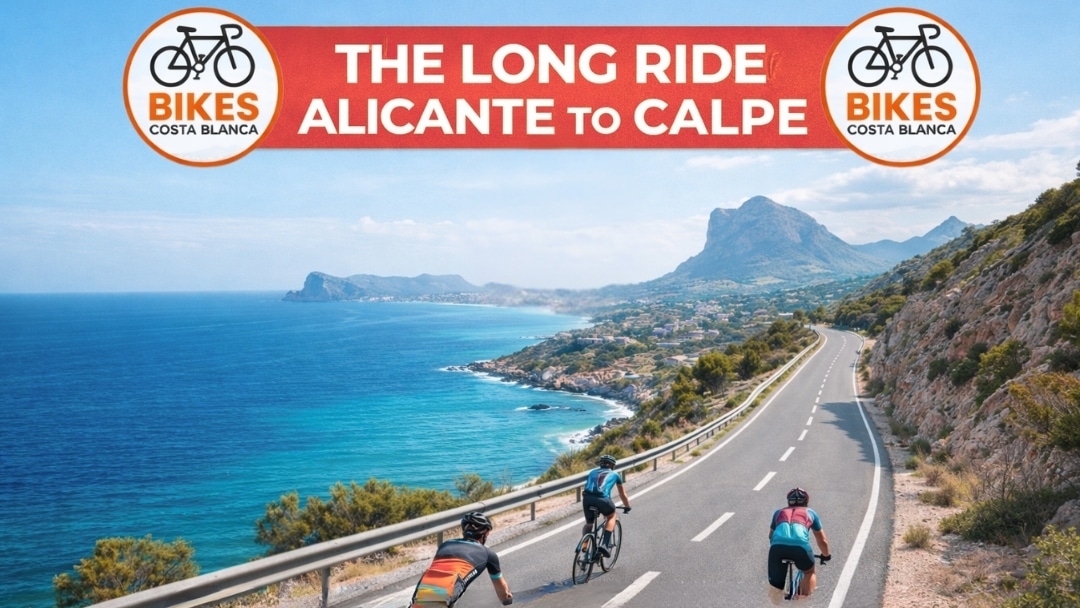
by Geroge Cornelius | 11, Mar 2026 | Bike Tours, Road Cycling Routes in Costa Blanca
Alicante to Calpe Ride / Key Takeaways
| Distance |
60-137km depending on route choice |
| Elevation Gain |
1,500-2,500m typical |
| Best Months |
October-May (avoiding summer heat) |
| Difficulty |
Intermediate to Advanced |
| Must-Do Climbs |
Coll de Rates, Puerto de Tudons |
| Pro Training Season |
January-April |
| Distance |
60-137km depending on route choice |
Ever wonder why pro cyclists flock to this corner of Spain every winter? Its not just the paella (though that helps). Costa Blanca gets about 300 days of sunshine each year – thats basically perfect riding weather when northern Europe is frozen solid.
The roads here? They’re butter smooth. Local governments actually invest in cycling infrastructure because they know riders bring serious money to the region. You’ll find dedicated bike lanes on major roads and drivers who actually respect cyclists – imagine that! Professional teams like Jumbo-Visma and UAE Team Emirates set up their winter camps here, so dont be surprised if you’re grinding up a climb and Tadej Pogačar flies past you.
What really sets this place apart from Mallorca or the Alps is the variety. You can hammer flat coastal roads in the morning, then tackle 1,000-meter climbs after lunch. The temperature rarely drops below 10°C in winter or exceeds 30°C in summer mornings. Plus, unlike touristy Mallorca, accomodation here won’t break the bank – you can find decent cyclist-friendly hotels for 50-70 euros a night.
The Classic Alicante to Calpe Coastal Route
Starting from Alicante’s marina, the most direct coastal route to Calpe stretches about 62 kilometers. But who wants direct when you can have spectacular? The smart move is taking the N-332 coastal road through El Campello and Villajoyosa to Relleu route for some inland variety.
First 20km out of Alicante are pancake flat – perfect for warming up those legs. You’ll roll through San Juan beach (grab a cortado at Café Racer if you need caffeine) then hit El Campello where the road starts getting interesting. The stretch between Villajoyosa and Benidorm throws in some punchy little climbs – nothing huge, maybe 3-4% gradients, but enough to wake up your legs.
Benidorm marks the halfway point. Yeah, its touristy as hell, but the cycling infrastructure here is top-notch. Wide bike lanes, plenty of water fountains, and if you need any bike repair services in Costa Blanca, there’s at least five shops within a kilometer of the main strip. From Benidorm to Altea, you’ve got two choices: stick to the coast (easier, more traffic) or take the CV-755 inland road (harder, way prettier).
The final push from Altea to Calpe is where things get spicy. That innocent-looking bump on your GPS? That’s the Puerto de Calpe – only 2km but it kicks up to 8% in places. Your reward? Rolling into Calpe with the massive Peñón de Ifach rock formation welcoming you like a giant limestone high-five.
Mountain Passes You’ll Conquer Between Alicante and Calpe
Lets talk about the climbs that make grown cyclists cry (in a good way). Coll de Rates is the superstar here – 6.3km of perfectly graded switchbacks averaging 5.8%. The locals call it “El Rates” and if you can do it in under 20 minutes, you’re flying. The road surface is pristine, and those hairpin turns? Chef’s kiss. Best part – there’s a restaurant at the top where they make killer bocadillos.
Puerto de Tudons is the beast everyone respects. Starting from sea level near Benidorm’s bike rental shops, you’ll climb for 20 straight kilometers. The gradient never gets stupid steep – hovering around 5% – but the sheer length will test your mental game. Pro tip: theres a water fountain at km 12 near the Confrides turn-off. Use it.
Port de Confrides might be the “easiest” of the big three at 7.5km and 5% average, but don’t let that fool you. The middle section has some sneaky 9% ramps that’ll have you searching for gears you dont have. What makes this climb special is the views – on clear days you can see all the way to Ibiza. The descent back toward Benidorm? Absolute rocket ship territory – I’ve hit 75km/h without even trying (please be careful though).
Then there’s the lesser-known Port de Sa Creueta from Tárbena. Only locals and cycling nerds know about this one. It’s quieter than a library, the road’s narrow but perfect, and you might see more goats than cars. At 7.5km with a mellow 3.4% average, its perfect for recovery days when you still want to bag a climb.
The 137km Puerto de Tudons Epic Loop
This route is what separates tourists from serious cyclists. Starting in Calpe’s cycling hub, you head south through Altea and Benidorm before the real fun begins. The first 30km are basically a warm-up – coastal roads, maybe a headwind if you’re unlucky, nothing too taxing.
Once you pass Benidorm and hit Finestrat, the landscape changes completely. Suddenly you’re surrounded by orange groves and almond trees, and that big mountain ahead? Yeah, you’re going up that. The climb through Finestrat to Sella is where you earn your pasta later. Its not just the gradient (averaging 6% for 8km) – its the way the road snakes through these ancient terraced hillsides that haven’t changed in centuries.
Sella to Castell de Castells is the route’s hidden gem. This 25km section rolls through proper Spanish countryside – the kind where old guys still ride donkeys and time forgot to show up. The road surface can be sketchy in places (watch for gravel in corners), but the lack of traffic makes up for it. There’s a bar in Castell de Castells that does the best tortilla española you’ll ever taste – seriously, its worth the climb just for that.
The return leg via Benigembla and Parcent is fast. Like, scary fast if you’re not careful. From Castell de Castells, you drop 600 meters in about 15km. The corners are well-marked but respect them – I’ve seen too many riders overcook that left-hander after the Benigembla church. Once you hit the valley floor near Jalón, its a gradual false flat back to Calpe. Total time? Budget 5-6 hours if you’re reasonably fit, longer if you stop for photos (and you will).
Alternative Routes: The Vall de Laguar Adventure
Want something different? The Vall de Laguar loop from Calpe is 104km of pure eye candy. This isnt about setting Strava records – its about riding through landscapes that look like someone cranked the saturation slider to maximum.
The route kicks off mellow enough, following the Jalón Valley scenic loop before things get serious. Between kilometer 20 and 40, you’re basically climbing non-stop from 200m to nearly 1,000m elevation. The road through Vall de Laguar itself is engineering porn – switchback after switchback carved into vertical canyon walls. In February and March, the whole valley explodes with cherry blossoms. Its so stupidly beautiful that you’ll forget your legs are screaming.
The technical crux comes around km 35 near Fleix. The road narrows to barely a car width, the gradient hits 12% for a few hundred meters, and there’s usually a headwind just to keep things interesting. But then you pop out on top of the ridge and BAM – Mediterranean views that make Instagram influencers weep with envy.
After conquering the valley, you still got Coll de Rates to deal with on the way back. By this point your legs are cooked, but approaching Rates from the Parcent side is actually easier than the classic Calpe approach. The descent back to Calpe via Jalón is fast and flowing – perfect for spinning out those tired legs. Pack extra food for this one – there’s limited resupply options in the valley villages.
Essential Stops and Refueling Points
Knowing where to refuel can make or break your ride. In Altea, Café Cycling (yes, thats really its name) on the main strip has become the unofficial cyclist HQ. They do proper coffee, have bike racks, and the owner – an ex-pro from Belgium – gives solid route advice.
The Petrol station at La Nucía (junction of CV-70 and CV-758) is clutch for long rides. They’ve got cold drinks, energy bars, and crucially, clean toilets. The attendant there has seen enough cyclists that he keeps extra water bottles in the fridge during summer. Between Sella and Relleu, there’s a natural spring fountain that locals have used for centuries – the water’s cold and tastes better than anything from a bottle.
For proper food, time your ride to hit Polop around lunchtime. Bar La Plaza does a menu del día for 12 euros that’ll properly refuel you – we’re talking proper Spanish portions here. If you’re doing the mountain routes, the restaurant at Coll de Rates summit is open most days and their tortilla sandwich has achieved legendary status among local cyclists. They also let you fill bottles for free, even if you dont buy anything.
Emergency bike repair spots along these routes include Bikes Benidorm (open 7 days), Ciclos Guerola in Altea (closed Sundays), and Natural Bikes in Calpe. Most carry basic spares and can handle common repairs while you wait.
Frequently Asked Questions
What’s the best time of year to cycle from Alicante to Calpe? October through May offers the best conditions. Summer (July-August) gets properly hot with temperatures hitting 35°C+ by midday. Spring (March-May) is perfect – warm but not hot, and everything’s green from winter rains.
Do I need a road bike or will a hybrid work? You really want a road bike for these routes. The climbs are long and a heavy hybrid will make them miserable. Most bike rental shops offer carbon road bikes from around 40-50 euros per day.
How fit do I need to be for these routes? For the direct coastal route, moderate fitness is fine. For the mountain loops, you should be comfortable riding 100km with 2,000m of climbing. If you can ride for 4-5 hours at home, you’ll manage here.
Is it safe to cycle alone in Costa Blanca? Generally very safe. Drivers are used to cyclists, crime is low, and there’s good mobile coverage almost everywhere. Still, tell someone your route and carry basic repair kit. Check out these safety tips for solo touring.
Where should I base myself for cycling in this area? Calpe is the traditional choice – central location, tons of bike shops, cyclist-friendly hotels. Altea works great too and is slightly less touristy. Benidorm has the most amenities but can be crowded.
Can I join group rides with locals? Absolutely! Most bike shops organize group rides. In Calpe, check out the Saturday morning ride from Ciclos Boluda – mixed abilities, super welcoming. Just rock up around 8:30am.
For cyclists travelling along the Costa Blanca, the journey from Alicante to Calpe is one of the most scenic coastal rides in the region. Rather than staying on the busy N-332, a safer cycling route uses a mix of coastal promenades, secondary roads, and cycle paths where available.
Route Overview
- Distance: approx. 72–78 km
- Elevation: Mostly rolling coastal terrain
- Difficulty: Moderate
- Surface: Tarmac (roads and promenades)
- Best bike: Road bike or gravel bike
Recommended Cycling Route
This route keeps cyclists away from the busiest traffic where possible.
- Alicante → Playa de San Juan
Use the coastal cycle paths leaving Alicante city and follow the seafront through San Juan Beach.
- Playa de San Juan → El Campello
Dedicated cycle lanes and quieter coastal streets make this a relaxed start to the ride.
- El Campello → Villajoyosa
Follow the coastal road sections parallel to the N-332. This stretch offers spectacular sea views.
- Villajoyosa → Benidorm
A gentle rolling section with some climbs before descending into Benidorm.
- Benidorm → Albir → Altea
Ride along the coast via Albir promenade and continue into the beautiful old town area of Altea.
- Altea → Calpe
Quiet coastal roads with stunning views of the Mediterranean and the famous Peñón de Ifach as you approach Calpe.
Highlights Along the Ride
🚴 Coastal scenery almost the entire route
☕ Plenty of cafés and beach stops along the way
📸 Photo opportunities in Villajoyosa’s colourful harbour
🌅 Historic old town views in Altea
🪨 Finish beneath the iconic Peñón de Ifach rock in Calpe
Cycling Tips
- Start early morning to avoid traffic and heat.
- Avoid the N-332 main carriageway where possible.
- Carry two bottles — the coastal sun can be strong even in winter.
- Many cafés along the route are cyclist-friendly.
Cycling Route Disclaimer
The cycling routes, maps, GPX files, and information published by Bikes Costa Blanca are provided for general guidance and inspiration only.
While we aim to share enjoyable and practical cycling routes across the Costa Blanca, conditions on roads and trails can change at any time due to traffic, construction, weather, road surface conditions, or local regulations.
Cyclists choosing to follow any route featured on this website or associated materials do so entirely at their own risk.
Bikes Costa Blanca makes no guarantees that any route is completely accurate, suitable for all cyclists, or free from hazards. Route descriptions, distances, elevations, and safety information should be treated as approximate guidance only.
It is the responsibility of each rider to:
- Assess road and traffic conditions
- Ride within their own ability and fitness level
- Ensure their bicycle is in safe working condition
- Follow all local traffic laws and regulations
- Use appropriate safety equipment
By using any route, map, GPX file, or cycling information provided by Bikes Costa Blanca, you acknowledge that Bikes Costa Blanca and its contributors accept no liability for any injury, loss, damage, or inconvenience that may arise from the use of this information.
Cyclists should always use their own judgement and take appropriate precautions when riding.
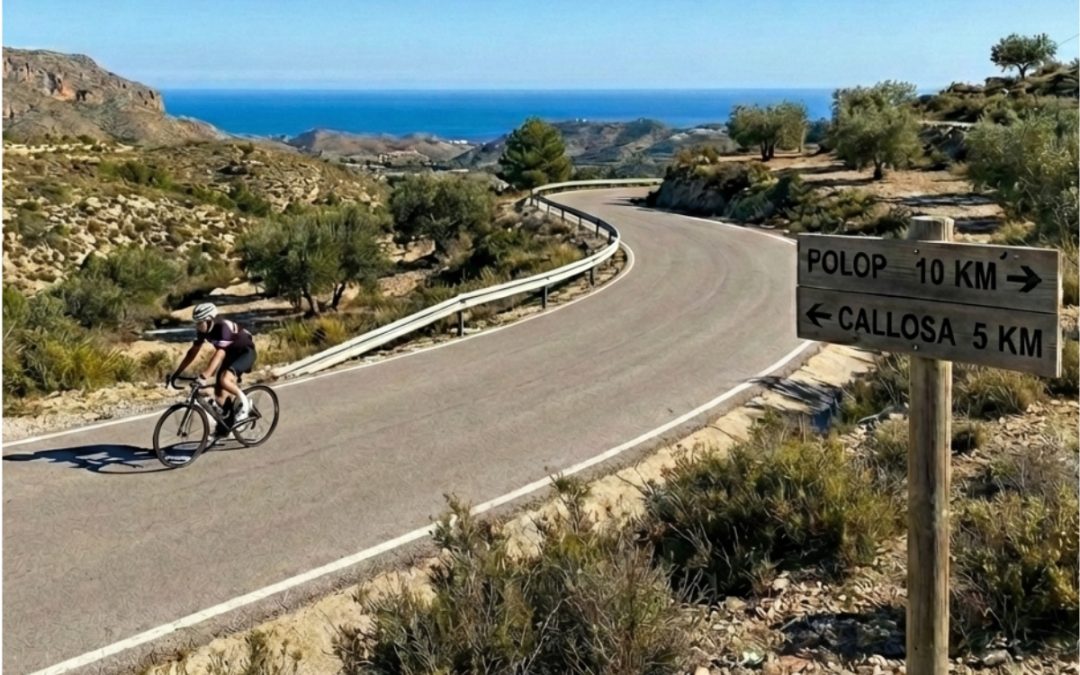
by Ralf Tenbrink | 23, Feb 2026 | Bike Tours, Road Cycling Routes in Costa Blanca
Polop to Callosa Route
Key Takeaways
| Feature |
Details |
| Distance from Coast |
25 minutes inland from Calpe |
| Main Climbs |
Carretera de Xirles (2.5 miles, 4%), La Nucía (2.2 miles, 3.1%), Carrer Aitana (2 miles, 4.3%) |
| Highest Point |
Alto de Aitana at 1,558 meters |
| Typical Elevation Gain |
2,275 meters over 132 kilometers |
| Hardest Climb |
Port de Bernia – 5km at 12% average, peaks at 15% |
| Best Season |
Winter and early spring when Alpine routes are snow-covered |
| Route Difficulty |
Ranges from moderate training rides to challenging gran fondo routes |
| Road Conditions |
Smooth, well-maintained asphalt with minimal traffic |
Why Cyclists Choose the Polop to Callosa Corridor
The Polop to Callosa route sits in a sweet spot for serious riders. Its just 25 minutes from Calpe but feels like a different world – no coastal traffic, no urban navigation headaches. You get proper climbing without the hassle of getting there. Local riders have known about this area for years, but it doesnt get the same crowds as routes starting from Benidorm or Calpe itself.
What makes this corridor special is the elevation profile. Even in January, you’re climbing above 1,000 meters when Alpine passes across Europe are buried under snow. Professional teams figured this out ages ago – they come here for winter training camps because the climbing is legit but the weather stays rideable. The roads wind through villages that havent changed much in decades, and you get those big Mediterranean views without the coastal development blocking your sight lines.
The area around Callosa d’en Sarria works as a base because you can design routes in multiple directions. Want a recovery ride? Theres options. Need to test your fitness? Theres climbs that’ll do that too. This flexibility matters when you’re planning a cycling holiday in Costa Blanca or just trying to get quality training done.
The Main Climbs You’ll Encounter
Three climbs define the Polop area, and each one has its own character. Carretera de Xirles via Polop stretches 2.5 miles with 531 feet of climbing at a 4% average gradient. Its steady rather than punchy – the kind of climb where pacing matters more than explosive power. La Nucía via Polop is shorter at 2.2 miles with 364 feet of vertical and a gentler 3.1% average. This one works well as a warmup or when you’re already tired from earlier efforts.
Carrer Aitana via Polop splits the difference – 2 miles, 453 feet of climbing, 4.3% average. None of these climbs will destroy you with steep ramps, but they add up quickly when you string them together. The asphalt quality is excellent throughout, which sounds boring but actually matters a lot when you’re grinding away for hours.
Then theres Coll de Rates, probably the most famous climb in Costa Blanca. Six kilometers at 6% average with switchbacks that photograph beautifully. The road surface is perfect, and the views keep you distracted from the effort. Its become a benchmark – if you can ride Coll de Rates comfortably, you can handle most of what Costa Blanca offers.
But the real test? Port de Bernia. Five kilometers at a 12% average grade, with the final 3.5 kilometers never dropping below 15%. They resurfaced it in 2019, and the professional Volta a Valenciana race included it shortly after. Its brutal. Your legs will remember it.
Understanding the Elevation Gains
Routes through the Polop-Callosa corridor deliver serious climbing numbers. The Gran Fondo Internacional La Nucía, designed by Miguel Indurain (yes, that Indurain – five-time Tour de France winner), covers 132 kilometers with 2,275 meters of elevation gain. That’s not a typo. The route starts with a 3.6-kilometer climb at 5.5% within the first 20 kilometers, just to get your legs warmed up.
The big one comes at 45 kilometers – Alto de Aitana, the highest point in Alicante province at 1,558 meters. The climb averages 3-4% with a descent halfway through that gives your legs a break before the final push. Its not steep by Alpine standards, but the sustained effort at altitude adds up. You feel it.
For comparison, a typical hard route like the Loop Sa Creueta and Bernia covers 97 kilometers with 1,617 meters of climbing. Port de Sa Creueta measures 7.5 kilometers at 3.4% – described by locals as “a nice climb away from traffic.” Port de Confrides, also 7.5 kilometers but at 5%, peaks at 970 meters with views across the Mediterranean that make you forget about the burning in your quads.
More ambitious loops can include three Category 1 climbs, two Category 3 climbs, and three Category 4 climbs within approximately 170 kilometers and 3,556 meters of elevation gain. Thats a full day in the saddle.
How the Calpe Connection Works
Most riders base themselves in Calpe because it has the infrastructure – bike rental shops, accommodations, cafes that understand cyclists. From there, its a short ride inland to Callosa d’en Sarria, where the real climbing begins. This connection creates natural loop routes that start and end at the coast but spend most of their distance in the mountains.
The loop structure matters because it gives you options. You can ride out through one valley, climb over the mountains, and descend through a different valley back to the coast. Or you can create figure-eight patterns that let you hit multiple climbs without repeating roads. The network of quiet roads through villages like Gorga, Balones, Benimassot, Fageca, Famorca, Castell de Castells, and Benigembla links together beautifully.
These aren’t main roads with heavy traffic. They’re the kind of roads where you might see more cyclists than cars on a Saturday morning. The villages themselves offer places to refill water bottles and grab a quick coffee, but they’re not tourist traps. They’re just… villages. People live there, go about their lives, and happen to have some of the best cycling roads in Europe running past their front doors.
Why Winter Riding Here Makes Sense
The Polop-Callosa corridor really shines from November through March. While riders in Northern Europe are stuck on trainers or battling ice, you’re climbing above 1,000 meters in sunshine. The Mediterranean moderates the temperature – its not tropical, but its rideable. You might need arm warmers in the morning, but by midday you’re in short sleeves.
Professional teams figured this out years ago. National squads from colder countries come here for training camps because they can get quality altitude work without extreme cold. The combination of elevation and mild weather is hard to find elsewhere in Europe during winter months.
The lack of forest cover on most climbs means you get constant views. This might sound like a small thing, but it makes a psychological difference. Alpine climbs often wind through dense forest where you can’t see anything except the next 50 meters of road. Here, you can see the Mediterranean, the coastal plains, the valleys below. It helps. Your brain has something to focus on besides the effort.
Different Routes for Different Riders
The corridor works for various fitness levels, which is rare for a climbing area. Gentle training rides exist – 7.5 to 20 kilometer climbs at 5-6% gradients that build fitness without destroying you. Then theres the “out-and-out walls” for testing yourself when you want to know where your fitness really stands.
Recreational riders can design routes through the quieter villages that combine short climbs with rolling terrain. These routes might only include 1,000-1,500 meters of climbing over 80-100 kilometers – still a solid day, but achievable if you’re not racing. The roads link together well, so you can create loops that bring you back to your starting point without complicated navigation.
For riders who want to suffer (and we all do sometimes), routes exist with 3,500+ meters of climbing over 170 kilometers. These routes include multiple Category 1 climbs and will take most of a day. You’ll need to start early, carry enough food, and pace yourself. But if you finish one of these routes, you’ve earned your post-ride beer.
The La Aitana Tour offers both a 90-kilometer media fondo and a 160-kilometer gran fondo option, giving riders a structured event experience if thats what they prefer over self-guided routes.
Comparing This Route to Other Costa Blanca Options
Routes starting from Calpe and Benidorm get more attention in guidebooks and online forums. They’re not bad routes – they’re actually quite good. But they come with compromises. You spend more time navigating through developed areas, dealing with traffic lights, and sharing roads with cars. The Polop-Callosa approach skips most of that.
From Callosa, you’re immediately on quiet roads heading into the mountains. The elevation gain starts right away and continues consistently throughout your ride. You’re not fighting through urban sprawl to reach the good stuff – you’re already there. This matters when you only have a few hours to ride or when you’re trying to maximize training quality.
The difficulty profiles are comparable to the more famous routes, but the experience feels different. Less commercial, fewer riders, more of that feeling of discovering something yourself even though locals have been riding these roads for decades. The inclusion of this area in major events like the UCI-sanctioned Gran Fondo La Nucía validates what local riders already knew – this is serious cycling territory.
Planning Your Ride Through This Area
The infrastructure for cycling tourism has improved significantly in recent years. Accommodations in Costa Blanca understand cyclists now – they offer secure bike storage, early breakfasts, and can recommend routes based on your fitness level. Bike shops throughout the area stock parts and can handle repairs if something goes wrong.
Starting from Callosa d’en Sarria gives you flexibility. You’re close enough to the coast to access services but far enough inland to avoid the coastal crowds. Routes can be designed as out-and-backs, loops, or point-to-point rides depending on your logistics. The roads are well-marked, though downloading routes to your GPS makes navigation easier.
Water and food availability varies. The villages have small shops and cafes, but don’t expect options every 10 kilometers. Carry enough water for the climbs, and plan your stops around the villages. Most riders carry at least two bottles and some food for longer routes.
Weather can change quickly in the mountains. Even on sunny days, temperatures drop on descents after long climbs. Carry a lightweight jacket. The roads drain well after rain, but some descents can be slippery when wet – take it easy on the switchbacks.
Frequently Asked Questions
What’s the best time of year to ride the Polop to Callosa route?
Winter and early spring (November through March) offer the best conditions. Temperatures stay mild, roads are quiet, and you avoid the summer heat that can make climbing uncomfortable. This is when professional teams visit for training camps.
How difficult is this route compared to famous Alpine climbs?
The gradients are generally more moderate (3-6% average) compared to Alpine climbs, but the sustained nature and cumulative elevation gain make it challenging. Port de Bernia at 12% average is an exception and rivals difficult Alpine sections.
Can I ride this route if I’m not a strong climber?
Yes, but choose your route carefully. Shorter loops with 1,000-1,500 meters of climbing exist for recreational riders. The key is pacing yourself and not trying to match the routes designed for gran fondo events.
Where should I base myself for riding this area?
Calpe offers the most infrastructure for cyclists – bike rental options, accommodations, and services. Its 25 minutes from Callosa d’en Sarria, making it an ideal base for accessing the climbing routes.
Are the roads safe for cycling?
Yes, the inland roads through this corridor are generally quiet with minimal traffic. Road surfaces are well-maintained, and drivers in the area are accustomed to cyclists. The main roads near the coast have more traffic, but the climbing routes themselves are excellent.
Do I need a guide or can I ride independently?
The routes are well-suited for independent riding if you’re comfortable with GPS navigation. However, guided cycling tours are available if you prefer structured support or want local knowledge about the best routes.
What kind of bike do I need?
A road bike with a compact or semi-compact chainset works best. Given the sustained climbs and some steep sections (particularly Port de Bernia), having an easy gear is important. Most riders use 50/34 or 52/36 chainrings with an 11-32 or 11-34 cassette.
Are there bike shops along the route if I have mechanical issues?
Bike shops in the coastal towns can handle most repairs, but options are limited once you’re in the mountains. Carry basic tools, spare tubes, and know how to handle common mechanical issues. Mobile bike repair services operate in the area for more serious problems.
by Ralf Tenbrink | 16, Feb 2026 | Bike Tours, Road Cycling Routes in Costa Blanca
Altea Hills Loop
Key Takeaways
| Aspect |
Details |
| Location |
Altea, between Benidorm and Calpe in Alicante province |
| Difficulty Level |
Intermediate to Advanced |
| Route Distance |
Approximately 1.9 miles (3 km) for main climb |
| Average Gradient |
6.8% – 8.1% |
| Maximum Gradient |
11.6% |
| Elevation Gain |
Varies by specific route chosen |
| Best Season |
Year-round (Mediterranean climate) |
| Skill Required |
Moderate climbing experience recommended |
| Infrastructure |
Well-marked routes, dedicated cycle lanes |
| Scenic Value |
Coastal views, mountain landscapes, old town architecture |
Why Altea Hills Loop Is Perfect For Road Cyclists
Altea sits right between Benidorm and Calpe, and its become one of those places where cyclists just keep coming back. The weather stays pretty good all year – hot summers and winters that dont freeze you off your bike. What makes this place special isnt just one thing, its how everything comes together.
The coastal loop from Calpe to Denia gives you a taste of what this area offers, but the Altea Hills Loop takes it up a notch. You get proper climbs without having to travel hours into the mountains. The local government actually cares about cyclists here – they’ve put in dedicated cycle lanes and marked routes properly. You wont spend half your ride trying to figure out where you’re supposed to go.

Most people who ride here say the same thing – its the mix that works. You can do a gentle coastal ride one day, then tackle something that makes your legs burn the next. The infrastructure means you’re not constantly worried about traffic, and the views? Well, they make those tough climbs feel worth it when you stop to catch your breath.
Getting To Know The Altea Hills Terrain
The Panorámica Altea climb stretches about 1.9 miles with an 8.1% average gradient. That might not sound like much on paper, but when you’re actually riding it, you’ll feel every percent. Some sections near Altea Hills hit 11.6% maximum gradient over 1 kilometer – those bits will have you out of the saddle.
What catches people off guard is how the gradient changes. You’ll get a bit of relief, think “okay, this isn’t so bad,” then hit another steep section. The road surface is generally good though, so you can focus on your effort rather than dodging potholes.
Key terrain features:
- Switchbacks that require good bike handling
- Steep sections mixed with moderate climbs
- Generally well-maintained road surface
- Limited shade in summer months
- Coastal winds can affect your ride
The climb starts from sea level, which means you’re working against gravity from the start. Unlike some mountain climbs where you warm up gradually, this one gets serious pretty quick. If you’re coming from bike rental services in the area, make sure you get a bike with gearing that suits climbing.
Planning Your Altea Hills Loop Ride
You cant just show up and wing it – well, you can, but you’ll have a better time if you plan a bit. The loop works best if you start early, especially in summer. By 10am, the sun’s already pretty strong, and those exposed sections get hot.

Water is crucial. There’s not many places to refill once you’re on the climb, so carry more than you think you’ll need. I learned this the hard way on a July ride when I ran out halfway up and had to ration what was left. Not fun when you’re already struggling.
Pre-ride checklist:
- Check weather forecast (wind direction matters)
- Carry 2-3 bottles of water minimum
- Pack energy gels or bars
- Bring basic repair kit
- Download route to GPS device
- Tell someone your planned route
- Check bike gears work smoothly
The route connects well with other cycling routes in Costa Blanca, so you can extend your ride if you’re feeling strong. Some people combine it with the coastal route back to make a full day of it. Just remember – what goes up must come down, and you’ll need energy for the descent too.
What Makes This Climb Different From Others
Sierra de Bernia gets talked about more, but Altea Hills has its own character. The views hit different here – you’re climbing but the sea stays visible most of the way. That Mediterranean blue keeps you company as you grind up the gradient.
The switchbacks aren’t as tight as some mountain climbs, which is good if you’re not super confident with technical descending. You can carry more speed through the corners without feeling like you’re gonna fly off the edge. The road width is decent too – if a car needs to pass, there’s usually room without things getting sketchy.
What surprised me first time I rode it was how quiet it gets. You’d think being close to tourist towns it’d be busy, but once you’re properly into the climb, traffic drops off. You get this weird peaceful feeling, just you, your bike, and that burning in your legs.

Compared to the Jalon Valley scenic loop, Altea Hills is shorter but punchier. Jalon gives you rolling terrain, while this is more of a sustained effort. Both are great, just different challenges.
Training Tips For Tackling The Gradient
An 8.1% average gradient isn’t a joke if you’re not used to climbing. Your flat-land fitness wont translate directly. You need to train your body for sustained power output while your heart rate stays high.
Training approach:
- Build base endurance first (long, steady rides)
- Add hill repeats once a week
- Practice seated climbing (saves energy)
- Work on cadence control (don’t mash gears)
- Include some threshold intervals
- Practice eating while riding uphill
The biggest mistake people make is going too hard too early. You see the gradient, feel fresh, and attack it. Then halfway up you’re cooked and crawling. Better to start conservative, find your rhythm, then push harder if you’ve got energy left.
Your gearing matters more than you think. If you’re spinning out or grinding, you’re wasting energy. A compact chainset (50/34) with an 11-32 cassette works for most people. Don’t let pride keep you in harder gears – spin to win on climbs like this.
Recovery between efforts is important too. If you’re planning multiple days of riding around Costa Blanca, don’t hammer yourself into the ground on day one. The mountain biking trails nearby offer good active recovery options if you want to stay on the bike but take it easier.
Best Times Of Year To Ride Altea Hills
The Mediterranean climate means you can ride year-round, but some months are definitely better than others. Spring (March-May) is probably peak time – temperatures sit around 18-24°C, perfect for climbing. You’re warm enough that your muscles work properly, but not so hot that you’re melting.

Summer (June-August) gets properly hot. We’re talking 30°C+ regularly. If you’re riding then, start at sunrise. By 7am you can be halfway up before the real heat kicks in. Carry extra water and don’t be a hero – if you feel dizzy or sick, turn around.
Seasonal breakdown:
- Winter (Dec-Feb): Mild, 12-16°C, occasional rain, fewer tourists
- Spring (Mar-May): Perfect conditions, 18-24°C, busy with cycling groups
- Summer (Jun-Aug): Hot, 28-35°C, early morning rides essential
- Autumn (Sep-Nov): Good conditions return, 20-26°C, still busy
Autumn rivals spring for conditions. September can still be warm, but by October things cool down nicely. You get that sweet spot where its comfortable to climb but not cold on descents. Plus, the summer crowds have gone home, so roads are quieter.
Winter isn’t bad either, especially if you’re from northern Europe. What locals call “cold” is still warmer than most places. Just watch for rain – when it comes, it can make descents sketchy. The roads don’t have great drainage everywhere.
Connecting With Other Costa Blanca Routes
The beauty of Altea Hills is how it connects to other rides. You’re not stuck doing the same loop over and over. From the top, you can head inland toward Callosa or drop down to the coast and cruise to Calpe.
If you want a longer day, combine it with the Benidorm to Guadalest scenic ride. That adds serious distance and climbing, but the views up at Guadalest reservoir are worth it. Just make sure you’ve got the legs for it – that’s a proper full day in the saddle.
Popular route combinations:
- Altea Hills + coastal return to Calpe (50-60km)
- Altea Hills + Guadalest loop (100km+)
- Altea Hills + Callosa inland route (70km)
- Multiple laps of Altea Hills (for training)
The Villajoyosa to Relleu route is another good option if you want variety. It’s a different kind of climbing – more gradual but longer. Some days you want punchy climbs, other days you want sustained efforts. Having options keeps training interesting.
For something completely different, the long distance ride from Alicante to Calpe takes you through Altea. You could use the Hills loop as a detour or save it for another day. Point is, you wont get bored of riding around here.
What You’ll See Along The Way
The views are part of why people love this climb. You start down near sea level, old Altea town sitting pretty with its blue-domed church. As you climb, the perspective changes – suddenly you’re looking down on the town, the marina, the whole coastline stretching away.

The architecture changes too. Down in town its traditional Spanish buildings, whitewashed walls, narrow streets. Up in the hills you get modern villas, fancy houses with infinity pools. It’s interesting to see how the area’s developed, even if some of the new buildings aren’t exactly pretty.
On clear days (which is most days), you can see Benidorm’s skyscrapers to the south and Calpe’s Penon de Ifach rock to the north. The sea stays this incredible blue-green color that photographs never quite capture properly. You’ll want to stop for photos, but pick your spots – some corners don’t have much shoulder.
The vegetation is typical Mediterranean – pine trees, scrub, the occasional palm. Not lush like northern Europe, but it has its own beauty. In spring, wildflowers add splashes of color. By summer everything’s dried out and brown, but that’s part of the landscape’s character.
Practical Stuff: Where To Start And Finish
Most people start from Altea town itself. There’s parking near the old town, though it fills up quick in summer. Get there early or you’ll be circling looking for a spot. Some of the bike rental shops in town let you park if you’re renting from them, which is handy.
Starting point options:
- Altea old town (main option, parking available)
- Altea la Vella (quieter, less parking)
- Altea Hills itself (if staying nearby)
- Calpe (for longer loop version)
If you’re staying in Benidorm or Calpe, you can ride to the start. Adds distance but means no parking hassles. The coast road from Calpe is pretty straightforward – cycle lane most of the way, though watch for pedestrians near the beaches.
For food after, Altea old town has loads of cafes and restaurants. The climb finishes you’ll probably be hungry. There’s a few places up in Altea Hills too, though they’re pricier than down in town. Nothing beats a cold drink and some food after a hard ride though.
Toilets are available in town before you start. Once you’re on the climb, you’re on your own until you get back down. Plan accordingly – there’s not many discrete spots to stop if you need to.
Safety Considerations For The Descent
What goes up must come down, and the descent needs respect. That 11.6% maximum gradient works both ways – you can pick up serious speed if you’re not careful. The corners are generally safe if you take them right, but grab too much brake mid-corner and things can get interesting.
Descent safety tips:
- Check brakes before starting down
- Brake before corners, not in them
- Watch for gravel or debris
- Don’t cross center line on blind corners
- Keep weight back on steep sections
- Don’t follow too close to other riders
The road surface is mostly good, but there’s occasional rough patches. At speed, hitting a pothole can be nasty. Keep your eyes up, scan ahead, don’t fixate on your front wheel. If you see something sketchy, slow down before you reach it.
Traffic is usually light, but assume every corner has a car coming the other way. Some drivers take these roads quick, and they’re not always expecting cyclists. Bright clothing helps – you want to be seen from as far away as possible.
If you’re not confident descending, there’s no shame in taking it easy. You’ll still get down, just slower. Better that than crashing because you pushed beyond your skill level. The bike support services in the area are good, but you don’t want to need them.
Frequently Asked Questions
How hard is the Altea Hills Loop for a beginner cyclist? It’s challenging for beginners due to the sustained 8.1% gradient and steep sections up to 11.6%. If you’re new to cycling, build up your fitness with flatter routes first. The coastal routes offer easier alternatives to start with.
What kind of bike do I need for this route? A road bike with climbing gears works best. A compact chainset (50/34) and 11-32 cassette will make the steep sections manageable. Most bike rental shops in Calpe and Benidorm stock suitable bikes.
How long does the Altea Hills Loop take to complete? Depending on fitness and route variation, expect 1.5-3 hours. The main climb takes 15-30 minutes depending on your pace. Add time for the approach, descent, and any stops for photos or rest.
Is the route safe for solo cycling? Yes, its generally safe with good road conditions and light traffic. Tell someone your plans, carry a phone, and ride during daylight hours. The area has good mobile coverage if you need help.
What should I carry for this ride? Bring 2-3 water bottles, energy food, basic repair kit (spare tube, pump, tire levers), phone, and some cash. Sunscreen and sunglasses are essential in summer. A lightweight jacket is useful for the descent even on warm days.
Are there places to stop for food and water along the route? Options are limited once you’re on the climb itself. Stock up in Altea town before starting. There are some cafes in Altea Hills, but don’t rely on them being open. Carry everything you need.
Can I ride the Altea Hills Loop year-round? Yes, the Mediterranean climate allows year-round cycling. Spring and autumn offer the best conditions. Summer requires early starts to avoid extreme heat. Winter is mild but watch for occasional rain making descents slippery.
What’s the best direction to ride the loop? Most riders go clockwise, climbing from Altea town up to Altea Hills. This puts the main climb early in your ride when you’re fresh. The descent back is fast and fun as a reward for the hard work.
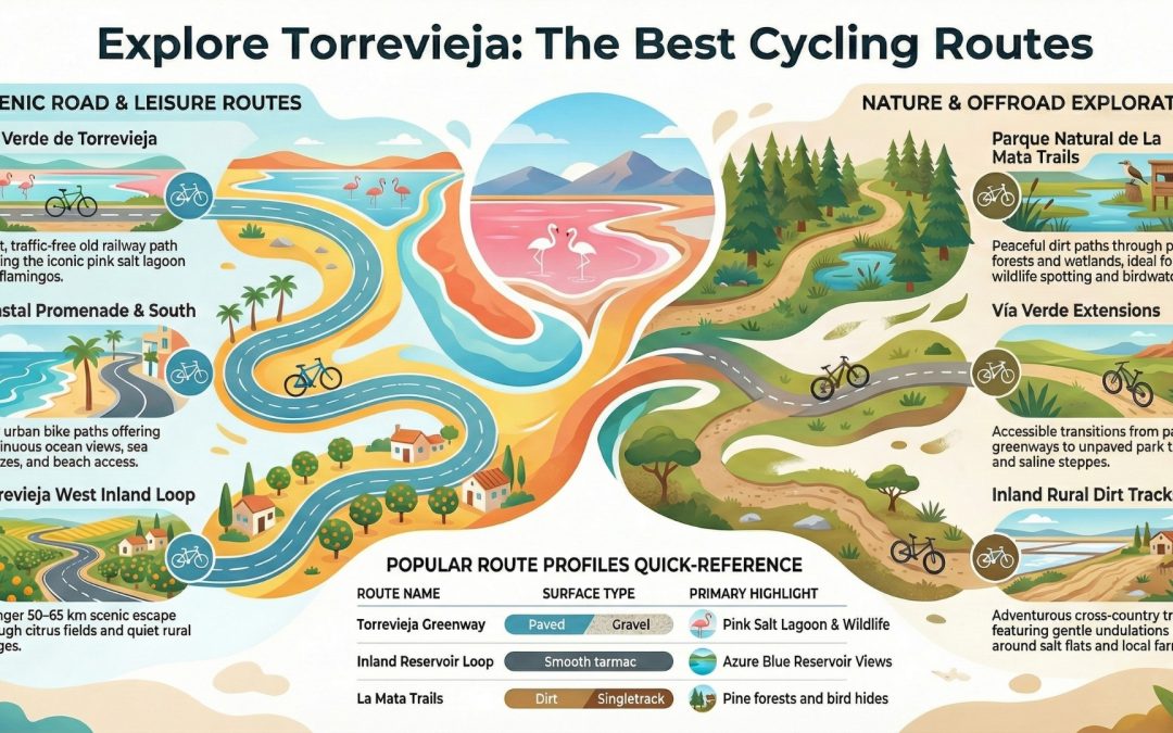
by Geroge Cornelius | 10, Feb 2026 | Bike Tours, Costa Blanca News, Torrevieja, Torrevieja Cycling
The Best Bike Rides in Torrevieja: Easy Greenways, Pink Lakes & More
The Torrevieja area, in the southern Costa Blanca, is one of Spain’s best destinations for relaxed, scenic cycling. Known for its flat terrain, coastal paths and famous salt lagoons, it’s ideal for road bikes, hybrids, gravel bikes, e-bikes and entry-level MTB riders.
Unlike the northern Costa Blanca (with its big mountain climbs), Torrevieja focuses on leisure cycling, nature rides and easy touring. Expect smooth greenways, traffic-free paths, quiet rural roads and gentle off-road trails through protected natural parks — perfect for families, holiday riders and anyone who prefers views over gradients.
Below are the most popular and well-known bike routes in Torrevieja, widely featured on platforms such as Komoot, Wikiloc and AllTrails, with GPX files available.
Top Road Cycling Routes in Torrevieja
Vía Verde de Torrevieja – Laguna Rosa Circular
- Type: Road / Hybrid / Gravel
- Distance: 12–15 km loop
- Elevation: Very flat (50–100 m)
Highlights:
Ride past the iconic pink waters of Laguna Rosa, spot flamingos, and enjoy a fully traffic-free former railway line.
Why it’s famous:
This is Torrevieja’s number-one cycling route — safe, accessible and visually stunning. Ideal for families, photographers and casual riders.
Natural Park of Las Lagunas de La Mata y Torrevieja Circular
- Type: Road / Gravel
- Distance: 20–30 km
- Elevation: Flat
Highlights:
Explore both the pink and blue lagoons within the Parque Natural de las Lagunas de La Mata y Torrevieja, with bird hides, wetlands and panoramic viewpoints.
Why it’s popular:
A top choice for nature lovers and birdwatchers, often combined with the Vía Verde for a longer eco-ride.
Torrevieja Inland Loop – San Miguel de Salinas & La Pedrera Reservoir
- Type: Road cycling
- Distance: 50–65 km
- Elevation: Gentle rolling (300–500 m)
Highlights:
Quiet countryside roads, citrus groves, traditional villages and the striking blue waters of the La Pedrera reservoir.
Why it’s popular:
Perfect for riders wanting a longer training ride without tough climbs.
Coastal Promenade to Punta Prima & Orihuela Costa
- Type: Road / Urban cycle path
- Distance: 20–40 km out-and-back
- Elevation: Flat
Highlights:
Beachfront cycling, sea views, cafés and easy connections to Playa Flamenca and beyond.
Why it’s popular:
An easy, everyday ride with plenty of coffee and swim stops.
Best Off-Road & MTB Routes Near Torrevieja
Torrevieja’s off-road riding is mainly cross-country and gravel-friendly, rather than technical downhill terrain.
La Mata Natural Park Trails
- Type: MTB / Gravel
- Distance: 10–25 km loops
- Elevation: Flat to gentle
Highlights:
Pine forests, sandy tracks, lagoons and excellent wildlife spotting.
Why it’s popular:
The best local MTB area, peaceful and scenic, with multiple loop options.
Vía Verde Extensions & Park Paths
- Type: Mixed gravel / dirt
- Distance: 15–30 km
- Elevation: Flat
Highlights:
Unpaved sections linking the greenway to saline steppe landscapes and reedbeds.
Why it’s popular:
A great introduction to off-road riding without technical difficulty.
Inland Rural Tracks & Cañadas
- Type: MTB / Gravel
- Distance: 20–50 km
- Elevation: Gentle undulations
Highlights:
Salt flats, farmland and open countryside toward San Miguel and La Pedrera.
Why it’s popular:
Favoured by local riders for long, exploratory XC rides.
Practical Cycling Tips for Torrevieja
- Best bikes: Hybrid, gravel, road, e-bike or XC MTB
- Best time to ride: October–May (summer mornings only)
- Wind can be a factor along the coast — plan loops accordingly
- Respect protected areas and stay on marked paths in natural parks
FAQs – Cycling in Torrevieja
- Is Torrevieja good for cycling beginners?
Yes. Torrevieja is very flat with traffic-free greenways and coastal paths, making it ideal for beginners and families.
- Can I cycle around the pink lake in Torrevieja?
Yes. The Vía Verde route loops around Laguna Rosa and is one of the area’s most popular and scenic rides.
- Are there mountain bike trails in Torrevieja?
Yes, mainly cross-country and gravel trails in La Mata Natural Park and nearby rural tracks, rather than technical downhill routes.
- What is the best bike for Torrevieja cycling?
Hybrid, gravel, road bikes and e-bikes are perfect. XC mountain bikes work well for park and inland dirt tracks.
- When is the best time of year to cycle in Torrevieja?
Autumn, winter and spring are ideal. Summer cycling is best early in the morning due to heat.