
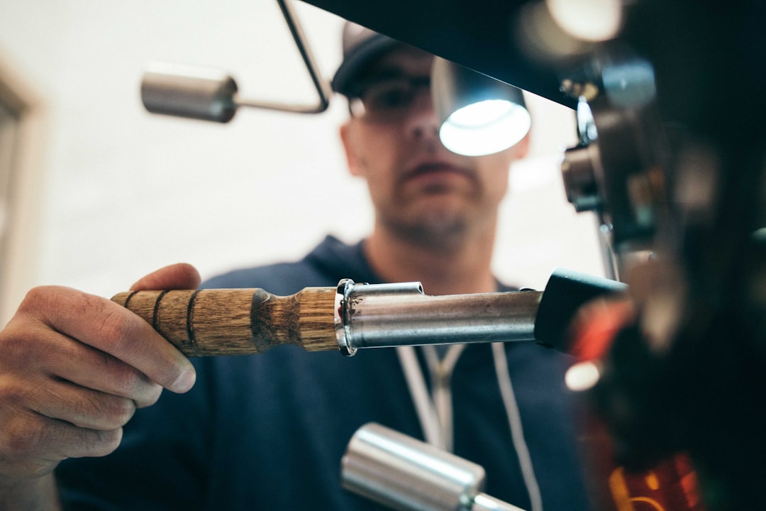
by Ralf Tenbrink | 2, Mar 2026 | Bike Rental Services in Costa Blanca, Costa Blanca News, Latest News
Top Bike Rental Shops in Alicante
Key Takeaways
| Topic |
Key Information |
| Best Premium Option |
Blanca Bikes offers exclusive Cervélo carbon bikes with 4 pickup locations |
| Most Convenient Service |
Peloton Belgica provides free bike delivery and collection at your location |
| Price Range |
Daily rentals start from €35 for road bikes, €60 for e-bikes |
| Main Rental Areas |
Altea, Calpe, Denia, Javea, Benidorm, and Jalon Valley |
| Bike Types Available |
Road bikes, e-bikes, mountain bikes, and gravel bikes |
| Booking Method |
Online booking available through company websites |
| Additional Services |
Bike fitting, guided tours, workshop repairs, and accommodation packages |
| Experience Level |
Options available for beginners through professional cyclists |
Finding the Right Bike Rental Shop in Costa Blanca
Costa Blanca has become a popular spot for cyclists from all over Europe. The weather stays nice most of the year, and the roads wind through mountains and along the coast. But how do you pick a good bike rental shop when you’re planning your trip?
Most rental shops in the area focus on road bikes because thats what most visitors want. You’ll find everything from basic models to professional-grade carbon bikes. The main towns for bike rentals are Calpe, Altea, Denia, and Benidorm – these places have the most options and the best infrastructure for cyclists.
When I first visited Costa Blanca, I made the mistake of booking the cheapest option I could find online. The bike worked fine, but the gears weren’t set up properly and I spent the first day adjusting everything myself. Now I always check what services come with the rental, not just the price.
For more information about cycling in the region, check out our guide on cycling routes which covers the best areas to explore.
Peloton Belgica started in September 2021 and they’ve built their business around convenience. They’ll bring the bike to wherever you’re staying – whether thats a hotel in Benidorm or a villa in Altea. And when you’re done? They come pick it up. No need to drive anywhere or worry about transportation.
Their bike selection focuses on high-end models. The Scott Addict series comes with electronic shifting – either SRAM eTap AXS or Shimano Di2. All bikes include powermeters, which is great if you like tracking your performance data. They also offer Ridley road bikes, which is a Belgian brand known for quality.
What really sets them apart is the bike fitting service. Before you ride, they adjust the bike to match your body measurements and riding style. This might sound like a small thing, but it makes a huge difference on longer rides. I’ve seen people struggle through 80km rides on poorly fitted bikes, and its not fun.
Service Areas:
- Altea (main base)
- Calpe
- La Nucia
- Polop
- Benidorm
- Finestrat
- Albir
They also offer package deals with Hotel Cap Negret in Altea. If you’re planning a dedicated cycling trip, these packages can save you money and hassle. You can explore more options for bike rentals across the Costa Blanca region.
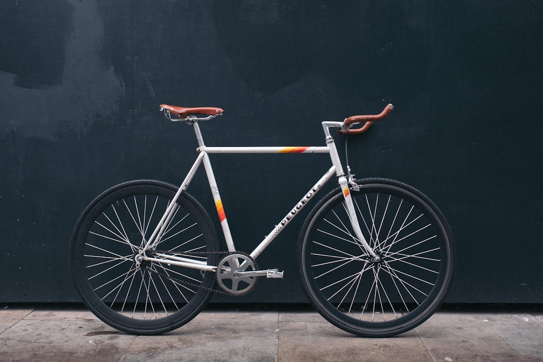
Blanca Bikes does one thing and does it well – they only rent Cervélo bikes. No other brands, no compromises. If you know bikes, you know Cervélo makes some of the best carbon frames in the world. If you dont know bikes, just trust me – these are really good bikes.
They have four locations where you can pick up or drop off bikes: Denia, Calpe, Parcent, and Javea. The Parcent location is special because its also their Base Camp Cafe and workshop. You can grab coffee, get repairs done, or join one of their guided tours all from the same place.
Pricing Structure:
| Bike Model |
Daily Rate |
Weekly Rate |
| Caledonia Rival eTAP AXS |
€35 |
Discounted |
| Caledonia-5 |
€40 |
Discounted |
| Soloist |
€45 |
Discounted |
| Pro Upgrades |
€53 |
Discounted |
| Rouvida E-bike |
€60 |
Discounted |
The longer you rent, the better the daily rate gets. They also offer premium delivery service to areas like Albir, Altea, Benidorm, and the Jalon Valley. This costs extra, but its worth it if you’re staying somewhere without easy access to their pickup locations.
Their workshop services are handy if something goes wrong during your trip. I once had a flat tire on day three of a week-long rental, and they fixed it within an hour at their Parcent location. For those interested in exploring the area, our Jalon Valley scenic loop is a perfect route to try.
Allure Bike Rental calls themselves “not the largest but definitely the best” rental company on Costa Blanca. Thats a bold claim, but their customer reviews back it up. They focus on providing excellent service rather than having the biggest fleet or the most locations.
The company emphasizes personalized attention. When you book with them, you’re not just getting a bike – you’re getting advice on routes, local knowledge, and support throughout your rental period. This approach works well for people who are new to the area or want more guidance.
Unfortunately, specific details about their bike models and pricing werent available in my research. But their reputation suggests they’re worth contacting directly if you value service quality over having the newest equipment. Sometimes a well-maintained older bike with great support beats a brand-new bike with no help.
Many cyclists who visit Costa Blanca regularly have their favorite rental shops, and Allure often comes up in conversations. Word-of-mouth recommendations mean alot in the cycling community. If you’re planning your first visit, check out our beginner’s guide to cycling Costa Blanca.
Other Bike Rental Options Across Costa Blanca
Beyond the main companies, several other rental shops operate throughout Costa Blanca. Each has its own focus and service area:
Northern Costa Blanca:
- Montgó Bikes (Denia area)
- Xabias Bike (Javea)
- TAO bike (various locations)
Central Costa Blanca:
- Start With Bike (Calpe – recommended for club riders)
- Azrentandbike (multiple areas)
General Services:
- Travel Costa Blanca (tour packages with rentals)
- Segway Eco Tours (alternative transport options)
- Segway Trip Denia (electric options)
Prices across these companies range from €5 per hour for basic bikes in Calpe to €60+ per day for specialized equipment. The hourly option works well if you just want to ride around town for a bit, but daily or weekly rates make more sense for serious cycling.
Start With Bike in Calpe gets mentioned alot by club riders – these are people who ride regularly and know what they’re looking for in a rental bike. That endorsement tells you something about their quality. For exploring the Calpe area specifically, we’ve compiled a list of top bike rental shops in Calpe.
What to Look for When Choosing a Rental Shop
Picking a bike rental shop isnt just about finding the cheapest option. Here’s what actually matters:
Bike Condition and Maintenance: Ask about their maintenance schedule. Good shops service their bikes regularly, not just when something breaks. Check reviews for mentions of mechanical problems – if multiple people complain about the same issues, thats a red flag.
Fitting and Setup: Can they adjust the bike to fit you properly? This includes saddle height, handlebar position, and cleat setup if you’re using clipless pedals. A proper fit prevents pain and injury.
Support Services: What happens if you get a flat tire 40km from your hotel? Do they offer roadside assistance? Can you swap bikes if something isnt working right? These questions matter more than you think.
Location Convenience: Where do you pick up and return the bike? If the shop is an hour’s drive from your accommodation, factor that into your decision. Some companies offer delivery, which solves this problem but usually costs extra.
Insurance and Damage Policies: What are you responsible for if something happens to the bike? Clear policies protect both you and the rental company. Read the fine print before you sign anything.
I learned this lesson the hard way when I scratched a frame on a rocky descent. The rental agreement said I was responsible for “all damage,” which ended up costing me €300. Now I always ask about insurance options upfront. You might also want to explore bike repair services in the area, just in case.
Booking Your Bike Rental: Practical Tips
Most rental shops in Costa Blanca accept online bookings. This is convenient, but it also means you need to plan ahead – especially during peak season (March through May and September through October).
How Far in Advance Should You Book? For popular periods, book at least 2-3 weeks ahead. If you’re visiting in summer or winter, you can probably book just a few days before. But why risk it? Booking early often gets you better rates anyway.
Payment Methods: Peloton Belgica uses Mollie payment service for online bookings. Most shops accept credit cards, but some smaller operations might prefer bank transfers or cash. Check before you assume.
What to Bring:
- Photo ID (passport or driving license)
- Credit card for deposit
- Your cycling shoes if you use clipless pedals
- Any specific measurements if you know them (saddle height, reach, etc.)
Communication: If you have specific requirements – like needing a compact chainring or preferring a certain saddle type – tell the rental shop when you book. Don’t assume they’ll have exactly what you want if you just show up.
Some shops offer package deals that include accommodation. If you’re planning a dedicated cycling holiday, these packages can save money and simplify logistics. Hotel Cap Negret in Altea partners with Peloton Belgica, for example. For more accommodation options, visit our Costa Blanca biking accommodation page.

Understanding Rental Costs and Value
Bike rental prices in Costa Blanca vary widely based on bike quality, services included, and rental duration. Here’s how to think about costs:
Daily vs Weekly Rates: Daily rates look expensive, but weekly rates usually offer significant discounts. If you’re staying for 5+ days, weekly rental almost always makes more sense financially.
What’s Included: Basic rental usually includes the bike, helmet, and basic tools. Premium services might include:
- Professional bike fitting
- Delivery and collection
- Roadside assistance
- GPS devices
- Spare wheels
- Nutrition products
Hidden Costs to Watch For:
- Delivery fees (can be €20-50 depending on distance)
- Damage deposits (usually €500-1000, refunded if no damage)
- Insurance options (€5-15 per day)
- Pedal upgrades (if you need specific types)
- Extra equipment (spare tubes, CO2 canisters, etc.)
Is Premium Worth It? If you’re riding 50+ kilometers per day, yes. The difference between a €35/day bike and a €53/day bike becomes very noticeable over long distances. Better components mean smoother shifting, lighter weight, and more comfort.
But if you’re just cruising around town or doing short rides, a basic rental works fine. Match the bike quality to your riding plans, not your ego. I’ve seen people rent €100/day bikes for gentle 20km rides along the coast – total waste of money.
For those planning extensive rides, our Benidorm to Guadalest scenic ride is a challenging but rewarding route.
Frequently Asked Questions
Do I need to book bike rentals in advance? Yes, especially during peak cycling season (March-May and September-October). Booking 2-3 weeks ahead ensures you get the bike you want. Last-minute bookings might work in summer or winter, but you’ll have fewer options.
What happens if the bike breaks down during my rental? Most reputable shops offer support for mechanical issues. Blanca Bikes has workshop locations, and Peloton Belgica provides assistance for their rentals. Always get the shop’s emergency contact number when you pick up the bike.
Can I rent a bike for just one day? Yes, all major rental shops offer daily rentals. However, weekly rates provide better value if you’re staying longer. Daily rates typically range from €35-60 depending on bike quality.
Do rental bikes come with helmets and tools? Basic equipment like helmets and essential tools usually comes included. However, confirm this when booking. Some shops charge extra for premium helmets or additional accessories.
What size deposit do I need to pay? Deposits typically range from €500-1000 depending on bike value. This gets refunded when you return the bike undamaged. Bring a credit card as most shops don’t accept cash deposits.
Are electric bikes available for rent? Yes, several shops offer e-bikes. Peloton Belgica rents Scott Genius eRIDE mountain bikes, and Blanca Bikes offers the Cervélo Rouvida e-bike starting at €60 per day.
Can the rental shop deliver the bike to my hotel? Peloton Belgica offers free delivery throughout their service area. Blanca Bikes charges extra for premium delivery to locations like Albir, Altea, and Benidorm. Check delivery options when booking.
What if the bike doesn’t fit me properly? Good rental shops provide fitting services. Peloton Belgica includes professional bike fitting with all rentals. If you’re uncomfortable during your first ride, contact the shop immediately – they should make adjustments.

by Ralf Tenbrink | 2, Mar 2026 | Cyclowax
Why Your Bike Chain Is Always Dirty (And How Hot Wax Fixes It)
If your chain goes from shiny silver to thick black paste after just a few rides, you’re not alone. Most riders in Europe still use traditional oil-based lubes, and those products almost guarantee a dirty drivetrain.
A big part of the solution is switching from wet, sticky lubrication to a dry, waxed chain. Let’s break down why your chain is always dirty and how hot wax fixes it.
Why your bike chain turns black so quickly
After a few rides, you’ll often notice:
Black grime on the chain and cassette
Greasy marks on your calf or clothing
“Crunchy” sounds when you pedal in the rain or on gravel
That black layer is a mix of:
Oil or liquid lube
Dust, sand, and road dirt
Tiny metal particles from normal wear
When all of this mixes together, it becomes a grinding paste that sticks to every surface. It doesn’t just look bad; it accelerates wear on your chain, cassette, and chainrings and can cost you real watts.
How traditional oil and liquid lubes actually work
Most riders grew up using two kinds of products:
Wet oil lubes
“Dry” or liquid wax lubes in a bottle
They’re easy to apply, but they share one problem: they stay wet or tacky on the surface of the chain.
That means:
Any dust or dirt you ride through clings to the lube.
Dirty lube gets pushed inside the chain when you pedal.
You end up needing degreasers and a lot of scrubbing to get things clean again.
So the more often you “top up” with oil, the more dirty paste you build up on your drivetrain.
What makes hot wax different
Hot wax works in a very different way.
Instead of staying wet, the wax is melted and the chain is immersed so the wax can penetrate the internals. Once the chain cools down, the wax solidifies and leaves a dry lubricating layer on the metal.
That dry layer means:
Dirt has almost nothing sticky to cling to.
Any dust that lands on the chain falls off more easily.
The wax inside the chain reduces friction where it really matters.
Because there’s no oily film on the outside, the chain doesn’t turn into a glue trap for grit, so it stays visually clean much longer.
Real-world benefits of a waxed chain
For everyday riders in Spain and across Europe, a properly waxed chain brings a few big advantages:
A drivetrain that stays clean
Your chain, cassette, and chainrings stay silver instead of black. Wiping the frame or your calf is no longer a constant chore.
Less friction, more speed
A clean, waxed chain reduces drag compared with a dirty oil-lubed chain. That can translate into measurable watt savings and a fresher feeling on climbs and long rides.
Longer component life
With less abrasive paste grinding away at your drivetrain, your chain and cassette can last significantly longer. Over time, that means fewer replacements and lower total cost of ownership.
Less mess at home
You don’t need aggressive degreasers every few weeks, which is more pleasant for you and kinder to the environment.
Is hot wax right for your riding style?
Hot wax isn’t just for pros. It works extremely well for:
Road riders who want a quiet, fast bike
Gravel cyclists dealing with dust and dirt on caminos and tracks
Mountain bikers riding in dry or mixed conditions
Commuters who don’t want black grease on trousers or bags
If you ride in very wet conditions constantly, you may need to re-wax more frequently, but the chain still stays cleaner than with traditional wet oil.
The key habit change is simple: instead of regularly adding more oil and degreasing everything, you ride until the wax coating is used up, then you re-wax.
How to switch from oil to hot wax (simple steps)
Moving from an oily chain to a waxed chain is easier than it looks. In practice, you have two main options:
Start with a pre-waxed chain
Buy a new chain that’s already stripped and waxed.
Have your local bike shop install it.
Keep your old, oily chain as a backup or clean it later.
This is the fastest, cleanest way to experience the difference.
Deep-clean your existing chain, then wax it
Remove the chain from the bike.
Thoroughly degrease it to remove all oil and factory grease.
Rinse and dry until there is no residue left.
Immerse it in hot wax following the instructions of your waxing kit.
Refit the chain and ride.
Once your chain is fully converted to wax, ongoing maintenance is straightforward: ride, re-wax at the recommended interval, and avoid adding any oil-based products on top.
Ask for Cyclowax in your local bike shop
If you’re tired of fighting against a black, greasy chain, hot wax is one of the most effective upgrades you can make to your bike’s maintenance routine.
You can:
Look for Cyclowax products online, or
Ask for Cyclowax by name in your local bike shop in Spain or elsewhere in Europe.
Shops can offer hot waxing as a service, stock waxing kits, and even sell pre-waxed chains, so riders get all the benefits of a clean, fast drivetrain without having to figure it out alone.
A chain that stays clean, runs smoothly, and lasts longer is not just nicer to look at—it makes every ride feel better.

by Ralf Tenbrink | 23, Feb 2026 | Bike Tours, Road Cycling Routes in Costa Blanca
Polop to Callosa Route
Key Takeaways
| Feature |
Details |
| Distance from Coast |
25 minutes inland from Calpe |
| Main Climbs |
Carretera de Xirles (2.5 miles, 4%), La Nucía (2.2 miles, 3.1%), Carrer Aitana (2 miles, 4.3%) |
| Highest Point |
Alto de Aitana at 1,558 meters |
| Typical Elevation Gain |
2,275 meters over 132 kilometers |
| Hardest Climb |
Port de Bernia – 5km at 12% average, peaks at 15% |
| Best Season |
Winter and early spring when Alpine routes are snow-covered |
| Route Difficulty |
Ranges from moderate training rides to challenging gran fondo routes |
| Road Conditions |
Smooth, well-maintained asphalt with minimal traffic |
Why Cyclists Choose the Polop to Callosa Corridor
The Polop to Callosa route sits in a sweet spot for serious riders. Its just 25 minutes from Calpe but feels like a different world – no coastal traffic, no urban navigation headaches. You get proper climbing without the hassle of getting there. Local riders have known about this area for years, but it doesnt get the same crowds as routes starting from Benidorm or Calpe itself.
What makes this corridor special is the elevation profile. Even in January, you’re climbing above 1,000 meters when Alpine passes across Europe are buried under snow. Professional teams figured this out ages ago – they come here for winter training camps because the climbing is legit but the weather stays rideable. The roads wind through villages that havent changed much in decades, and you get those big Mediterranean views without the coastal development blocking your sight lines.
The area around Callosa d’en Sarria works as a base because you can design routes in multiple directions. Want a recovery ride? Theres options. Need to test your fitness? Theres climbs that’ll do that too. This flexibility matters when you’re planning a cycling holiday in Costa Blanca or just trying to get quality training done.
The Main Climbs You’ll Encounter
Three climbs define the Polop area, and each one has its own character. Carretera de Xirles via Polop stretches 2.5 miles with 531 feet of climbing at a 4% average gradient. Its steady rather than punchy – the kind of climb where pacing matters more than explosive power. La Nucía via Polop is shorter at 2.2 miles with 364 feet of vertical and a gentler 3.1% average. This one works well as a warmup or when you’re already tired from earlier efforts.
Carrer Aitana via Polop splits the difference – 2 miles, 453 feet of climbing, 4.3% average. None of these climbs will destroy you with steep ramps, but they add up quickly when you string them together. The asphalt quality is excellent throughout, which sounds boring but actually matters a lot when you’re grinding away for hours.
Then theres Coll de Rates, probably the most famous climb in Costa Blanca. Six kilometers at 6% average with switchbacks that photograph beautifully. The road surface is perfect, and the views keep you distracted from the effort. Its become a benchmark – if you can ride Coll de Rates comfortably, you can handle most of what Costa Blanca offers.
But the real test? Port de Bernia. Five kilometers at a 12% average grade, with the final 3.5 kilometers never dropping below 15%. They resurfaced it in 2019, and the professional Volta a Valenciana race included it shortly after. Its brutal. Your legs will remember it.
Understanding the Elevation Gains
Routes through the Polop-Callosa corridor deliver serious climbing numbers. The Gran Fondo Internacional La Nucía, designed by Miguel Indurain (yes, that Indurain – five-time Tour de France winner), covers 132 kilometers with 2,275 meters of elevation gain. That’s not a typo. The route starts with a 3.6-kilometer climb at 5.5% within the first 20 kilometers, just to get your legs warmed up.
The big one comes at 45 kilometers – Alto de Aitana, the highest point in Alicante province at 1,558 meters. The climb averages 3-4% with a descent halfway through that gives your legs a break before the final push. Its not steep by Alpine standards, but the sustained effort at altitude adds up. You feel it.
For comparison, a typical hard route like the Loop Sa Creueta and Bernia covers 97 kilometers with 1,617 meters of climbing. Port de Sa Creueta measures 7.5 kilometers at 3.4% – described by locals as “a nice climb away from traffic.” Port de Confrides, also 7.5 kilometers but at 5%, peaks at 970 meters with views across the Mediterranean that make you forget about the burning in your quads.
More ambitious loops can include three Category 1 climbs, two Category 3 climbs, and three Category 4 climbs within approximately 170 kilometers and 3,556 meters of elevation gain. Thats a full day in the saddle.
How the Calpe Connection Works
Most riders base themselves in Calpe because it has the infrastructure – bike rental shops, accommodations, cafes that understand cyclists. From there, its a short ride inland to Callosa d’en Sarria, where the real climbing begins. This connection creates natural loop routes that start and end at the coast but spend most of their distance in the mountains.
The loop structure matters because it gives you options. You can ride out through one valley, climb over the mountains, and descend through a different valley back to the coast. Or you can create figure-eight patterns that let you hit multiple climbs without repeating roads. The network of quiet roads through villages like Gorga, Balones, Benimassot, Fageca, Famorca, Castell de Castells, and Benigembla links together beautifully.
These aren’t main roads with heavy traffic. They’re the kind of roads where you might see more cyclists than cars on a Saturday morning. The villages themselves offer places to refill water bottles and grab a quick coffee, but they’re not tourist traps. They’re just… villages. People live there, go about their lives, and happen to have some of the best cycling roads in Europe running past their front doors.
Why Winter Riding Here Makes Sense
The Polop-Callosa corridor really shines from November through March. While riders in Northern Europe are stuck on trainers or battling ice, you’re climbing above 1,000 meters in sunshine. The Mediterranean moderates the temperature – its not tropical, but its rideable. You might need arm warmers in the morning, but by midday you’re in short sleeves.
Professional teams figured this out years ago. National squads from colder countries come here for training camps because they can get quality altitude work without extreme cold. The combination of elevation and mild weather is hard to find elsewhere in Europe during winter months.
The lack of forest cover on most climbs means you get constant views. This might sound like a small thing, but it makes a psychological difference. Alpine climbs often wind through dense forest where you can’t see anything except the next 50 meters of road. Here, you can see the Mediterranean, the coastal plains, the valleys below. It helps. Your brain has something to focus on besides the effort.
Different Routes for Different Riders
The corridor works for various fitness levels, which is rare for a climbing area. Gentle training rides exist – 7.5 to 20 kilometer climbs at 5-6% gradients that build fitness without destroying you. Then theres the “out-and-out walls” for testing yourself when you want to know where your fitness really stands.
Recreational riders can design routes through the quieter villages that combine short climbs with rolling terrain. These routes might only include 1,000-1,500 meters of climbing over 80-100 kilometers – still a solid day, but achievable if you’re not racing. The roads link together well, so you can create loops that bring you back to your starting point without complicated navigation.
For riders who want to suffer (and we all do sometimes), routes exist with 3,500+ meters of climbing over 170 kilometers. These routes include multiple Category 1 climbs and will take most of a day. You’ll need to start early, carry enough food, and pace yourself. But if you finish one of these routes, you’ve earned your post-ride beer.
The La Aitana Tour offers both a 90-kilometer media fondo and a 160-kilometer gran fondo option, giving riders a structured event experience if thats what they prefer over self-guided routes.
Comparing This Route to Other Costa Blanca Options
Routes starting from Calpe and Benidorm get more attention in guidebooks and online forums. They’re not bad routes – they’re actually quite good. But they come with compromises. You spend more time navigating through developed areas, dealing with traffic lights, and sharing roads with cars. The Polop-Callosa approach skips most of that.
From Callosa, you’re immediately on quiet roads heading into the mountains. The elevation gain starts right away and continues consistently throughout your ride. You’re not fighting through urban sprawl to reach the good stuff – you’re already there. This matters when you only have a few hours to ride or when you’re trying to maximize training quality.
The difficulty profiles are comparable to the more famous routes, but the experience feels different. Less commercial, fewer riders, more of that feeling of discovering something yourself even though locals have been riding these roads for decades. The inclusion of this area in major events like the UCI-sanctioned Gran Fondo La Nucía validates what local riders already knew – this is serious cycling territory.
Planning Your Ride Through This Area
The infrastructure for cycling tourism has improved significantly in recent years. Accommodations in Costa Blanca understand cyclists now – they offer secure bike storage, early breakfasts, and can recommend routes based on your fitness level. Bike shops throughout the area stock parts and can handle repairs if something goes wrong.
Starting from Callosa d’en Sarria gives you flexibility. You’re close enough to the coast to access services but far enough inland to avoid the coastal crowds. Routes can be designed as out-and-backs, loops, or point-to-point rides depending on your logistics. The roads are well-marked, though downloading routes to your GPS makes navigation easier.
Water and food availability varies. The villages have small shops and cafes, but don’t expect options every 10 kilometers. Carry enough water for the climbs, and plan your stops around the villages. Most riders carry at least two bottles and some food for longer routes.
Weather can change quickly in the mountains. Even on sunny days, temperatures drop on descents after long climbs. Carry a lightweight jacket. The roads drain well after rain, but some descents can be slippery when wet – take it easy on the switchbacks.
Frequently Asked Questions
What’s the best time of year to ride the Polop to Callosa route?
Winter and early spring (November through March) offer the best conditions. Temperatures stay mild, roads are quiet, and you avoid the summer heat that can make climbing uncomfortable. This is when professional teams visit for training camps.
How difficult is this route compared to famous Alpine climbs?
The gradients are generally more moderate (3-6% average) compared to Alpine climbs, but the sustained nature and cumulative elevation gain make it challenging. Port de Bernia at 12% average is an exception and rivals difficult Alpine sections.
Can I ride this route if I’m not a strong climber?
Yes, but choose your route carefully. Shorter loops with 1,000-1,500 meters of climbing exist for recreational riders. The key is pacing yourself and not trying to match the routes designed for gran fondo events.
Where should I base myself for riding this area?
Calpe offers the most infrastructure for cyclists – bike rental options, accommodations, and services. Its 25 minutes from Callosa d’en Sarria, making it an ideal base for accessing the climbing routes.
Are the roads safe for cycling?
Yes, the inland roads through this corridor are generally quiet with minimal traffic. Road surfaces are well-maintained, and drivers in the area are accustomed to cyclists. The main roads near the coast have more traffic, but the climbing routes themselves are excellent.
Do I need a guide or can I ride independently?
The routes are well-suited for independent riding if you’re comfortable with GPS navigation. However, guided cycling tours are available if you prefer structured support or want local knowledge about the best routes.
What kind of bike do I need?
A road bike with a compact or semi-compact chainset works best. Given the sustained climbs and some steep sections (particularly Port de Bernia), having an easy gear is important. Most riders use 50/34 or 52/36 chainrings with an 11-32 or 11-34 cassette.
Are there bike shops along the route if I have mechanical issues?
Bike shops in the coastal towns can handle most repairs, but options are limited once you’re in the mountains. Carry basic tools, spare tubes, and know how to handle common mechanical issues. Mobile bike repair services operate in the area for more serious problems.

by Ralf Tenbrink | 16, Feb 2026 | Bike Tours, Road Cycling Routes in Costa Blanca
Altea Hills Loop
Key Takeaways
| Aspect |
Details |
| Location |
Altea, between Benidorm and Calpe in Alicante province |
| Difficulty Level |
Intermediate to Advanced |
| Route Distance |
Approximately 1.9 miles (3 km) for main climb |
| Average Gradient |
6.8% – 8.1% |
| Maximum Gradient |
11.6% |
| Elevation Gain |
Varies by specific route chosen |
| Best Season |
Year-round (Mediterranean climate) |
| Skill Required |
Moderate climbing experience recommended |
| Infrastructure |
Well-marked routes, dedicated cycle lanes |
| Scenic Value |
Coastal views, mountain landscapes, old town architecture |
Why Altea Hills Loop Is Perfect For Road Cyclists
Altea sits right between Benidorm and Calpe, and its become one of those places where cyclists just keep coming back. The weather stays pretty good all year – hot summers and winters that dont freeze you off your bike. What makes this place special isnt just one thing, its how everything comes together.
The coastal loop from Calpe to Denia gives you a taste of what this area offers, but the Altea Hills Loop takes it up a notch. You get proper climbs without having to travel hours into the mountains. The local government actually cares about cyclists here – they’ve put in dedicated cycle lanes and marked routes properly. You wont spend half your ride trying to figure out where you’re supposed to go.

Most people who ride here say the same thing – its the mix that works. You can do a gentle coastal ride one day, then tackle something that makes your legs burn the next. The infrastructure means you’re not constantly worried about traffic, and the views? Well, they make those tough climbs feel worth it when you stop to catch your breath.
Getting To Know The Altea Hills Terrain
The Panorámica Altea climb stretches about 1.9 miles with an 8.1% average gradient. That might not sound like much on paper, but when you’re actually riding it, you’ll feel every percent. Some sections near Altea Hills hit 11.6% maximum gradient over 1 kilometer – those bits will have you out of the saddle.
What catches people off guard is how the gradient changes. You’ll get a bit of relief, think “okay, this isn’t so bad,” then hit another steep section. The road surface is generally good though, so you can focus on your effort rather than dodging potholes.
Key terrain features:
- Switchbacks that require good bike handling
- Steep sections mixed with moderate climbs
- Generally well-maintained road surface
- Limited shade in summer months
- Coastal winds can affect your ride
The climb starts from sea level, which means you’re working against gravity from the start. Unlike some mountain climbs where you warm up gradually, this one gets serious pretty quick. If you’re coming from bike rental services in the area, make sure you get a bike with gearing that suits climbing.
Planning Your Altea Hills Loop Ride
You cant just show up and wing it – well, you can, but you’ll have a better time if you plan a bit. The loop works best if you start early, especially in summer. By 10am, the sun’s already pretty strong, and those exposed sections get hot.

Water is crucial. There’s not many places to refill once you’re on the climb, so carry more than you think you’ll need. I learned this the hard way on a July ride when I ran out halfway up and had to ration what was left. Not fun when you’re already struggling.
Pre-ride checklist:
- Check weather forecast (wind direction matters)
- Carry 2-3 bottles of water minimum
- Pack energy gels or bars
- Bring basic repair kit
- Download route to GPS device
- Tell someone your planned route
- Check bike gears work smoothly
The route connects well with other cycling routes in Costa Blanca, so you can extend your ride if you’re feeling strong. Some people combine it with the coastal route back to make a full day of it. Just remember – what goes up must come down, and you’ll need energy for the descent too.
What Makes This Climb Different From Others
Sierra de Bernia gets talked about more, but Altea Hills has its own character. The views hit different here – you’re climbing but the sea stays visible most of the way. That Mediterranean blue keeps you company as you grind up the gradient.
The switchbacks aren’t as tight as some mountain climbs, which is good if you’re not super confident with technical descending. You can carry more speed through the corners without feeling like you’re gonna fly off the edge. The road width is decent too – if a car needs to pass, there’s usually room without things getting sketchy.
What surprised me first time I rode it was how quiet it gets. You’d think being close to tourist towns it’d be busy, but once you’re properly into the climb, traffic drops off. You get this weird peaceful feeling, just you, your bike, and that burning in your legs.

Compared to the Jalon Valley scenic loop, Altea Hills is shorter but punchier. Jalon gives you rolling terrain, while this is more of a sustained effort. Both are great, just different challenges.
Training Tips For Tackling The Gradient
An 8.1% average gradient isn’t a joke if you’re not used to climbing. Your flat-land fitness wont translate directly. You need to train your body for sustained power output while your heart rate stays high.
Training approach:
- Build base endurance first (long, steady rides)
- Add hill repeats once a week
- Practice seated climbing (saves energy)
- Work on cadence control (don’t mash gears)
- Include some threshold intervals
- Practice eating while riding uphill
The biggest mistake people make is going too hard too early. You see the gradient, feel fresh, and attack it. Then halfway up you’re cooked and crawling. Better to start conservative, find your rhythm, then push harder if you’ve got energy left.
Your gearing matters more than you think. If you’re spinning out or grinding, you’re wasting energy. A compact chainset (50/34) with an 11-32 cassette works for most people. Don’t let pride keep you in harder gears – spin to win on climbs like this.
Recovery between efforts is important too. If you’re planning multiple days of riding around Costa Blanca, don’t hammer yourself into the ground on day one. The mountain biking trails nearby offer good active recovery options if you want to stay on the bike but take it easier.
Best Times Of Year To Ride Altea Hills
The Mediterranean climate means you can ride year-round, but some months are definitely better than others. Spring (March-May) is probably peak time – temperatures sit around 18-24°C, perfect for climbing. You’re warm enough that your muscles work properly, but not so hot that you’re melting.

Summer (June-August) gets properly hot. We’re talking 30°C+ regularly. If you’re riding then, start at sunrise. By 7am you can be halfway up before the real heat kicks in. Carry extra water and don’t be a hero – if you feel dizzy or sick, turn around.
Seasonal breakdown:
- Winter (Dec-Feb): Mild, 12-16°C, occasional rain, fewer tourists
- Spring (Mar-May): Perfect conditions, 18-24°C, busy with cycling groups
- Summer (Jun-Aug): Hot, 28-35°C, early morning rides essential
- Autumn (Sep-Nov): Good conditions return, 20-26°C, still busy
Autumn rivals spring for conditions. September can still be warm, but by October things cool down nicely. You get that sweet spot where its comfortable to climb but not cold on descents. Plus, the summer crowds have gone home, so roads are quieter.
Winter isn’t bad either, especially if you’re from northern Europe. What locals call “cold” is still warmer than most places. Just watch for rain – when it comes, it can make descents sketchy. The roads don’t have great drainage everywhere.
Connecting With Other Costa Blanca Routes
The beauty of Altea Hills is how it connects to other rides. You’re not stuck doing the same loop over and over. From the top, you can head inland toward Callosa or drop down to the coast and cruise to Calpe.
If you want a longer day, combine it with the Benidorm to Guadalest scenic ride. That adds serious distance and climbing, but the views up at Guadalest reservoir are worth it. Just make sure you’ve got the legs for it – that’s a proper full day in the saddle.
Popular route combinations:
- Altea Hills + coastal return to Calpe (50-60km)
- Altea Hills + Guadalest loop (100km+)
- Altea Hills + Callosa inland route (70km)
- Multiple laps of Altea Hills (for training)
The Villajoyosa to Relleu route is another good option if you want variety. It’s a different kind of climbing – more gradual but longer. Some days you want punchy climbs, other days you want sustained efforts. Having options keeps training interesting.
For something completely different, the long distance ride from Alicante to Calpe takes you through Altea. You could use the Hills loop as a detour or save it for another day. Point is, you wont get bored of riding around here.
What You’ll See Along The Way
The views are part of why people love this climb. You start down near sea level, old Altea town sitting pretty with its blue-domed church. As you climb, the perspective changes – suddenly you’re looking down on the town, the marina, the whole coastline stretching away.

The architecture changes too. Down in town its traditional Spanish buildings, whitewashed walls, narrow streets. Up in the hills you get modern villas, fancy houses with infinity pools. It’s interesting to see how the area’s developed, even if some of the new buildings aren’t exactly pretty.
On clear days (which is most days), you can see Benidorm’s skyscrapers to the south and Calpe’s Penon de Ifach rock to the north. The sea stays this incredible blue-green color that photographs never quite capture properly. You’ll want to stop for photos, but pick your spots – some corners don’t have much shoulder.
The vegetation is typical Mediterranean – pine trees, scrub, the occasional palm. Not lush like northern Europe, but it has its own beauty. In spring, wildflowers add splashes of color. By summer everything’s dried out and brown, but that’s part of the landscape’s character.
Practical Stuff: Where To Start And Finish
Most people start from Altea town itself. There’s parking near the old town, though it fills up quick in summer. Get there early or you’ll be circling looking for a spot. Some of the bike rental shops in town let you park if you’re renting from them, which is handy.
Starting point options:
- Altea old town (main option, parking available)
- Altea la Vella (quieter, less parking)
- Altea Hills itself (if staying nearby)
- Calpe (for longer loop version)
If you’re staying in Benidorm or Calpe, you can ride to the start. Adds distance but means no parking hassles. The coast road from Calpe is pretty straightforward – cycle lane most of the way, though watch for pedestrians near the beaches.
For food after, Altea old town has loads of cafes and restaurants. The climb finishes you’ll probably be hungry. There’s a few places up in Altea Hills too, though they’re pricier than down in town. Nothing beats a cold drink and some food after a hard ride though.
Toilets are available in town before you start. Once you’re on the climb, you’re on your own until you get back down. Plan accordingly – there’s not many discrete spots to stop if you need to.
Safety Considerations For The Descent
What goes up must come down, and the descent needs respect. That 11.6% maximum gradient works both ways – you can pick up serious speed if you’re not careful. The corners are generally safe if you take them right, but grab too much brake mid-corner and things can get interesting.
Descent safety tips:
- Check brakes before starting down
- Brake before corners, not in them
- Watch for gravel or debris
- Don’t cross center line on blind corners
- Keep weight back on steep sections
- Don’t follow too close to other riders
The road surface is mostly good, but there’s occasional rough patches. At speed, hitting a pothole can be nasty. Keep your eyes up, scan ahead, don’t fixate on your front wheel. If you see something sketchy, slow down before you reach it.
Traffic is usually light, but assume every corner has a car coming the other way. Some drivers take these roads quick, and they’re not always expecting cyclists. Bright clothing helps – you want to be seen from as far away as possible.
If you’re not confident descending, there’s no shame in taking it easy. You’ll still get down, just slower. Better that than crashing because you pushed beyond your skill level. The bike support services in the area are good, but you don’t want to need them.
Frequently Asked Questions
How hard is the Altea Hills Loop for a beginner cyclist? It’s challenging for beginners due to the sustained 8.1% gradient and steep sections up to 11.6%. If you’re new to cycling, build up your fitness with flatter routes first. The coastal routes offer easier alternatives to start with.
What kind of bike do I need for this route? A road bike with climbing gears works best. A compact chainset (50/34) and 11-32 cassette will make the steep sections manageable. Most bike rental shops in Calpe and Benidorm stock suitable bikes.
How long does the Altea Hills Loop take to complete? Depending on fitness and route variation, expect 1.5-3 hours. The main climb takes 15-30 minutes depending on your pace. Add time for the approach, descent, and any stops for photos or rest.
Is the route safe for solo cycling? Yes, its generally safe with good road conditions and light traffic. Tell someone your plans, carry a phone, and ride during daylight hours. The area has good mobile coverage if you need help.
What should I carry for this ride? Bring 2-3 water bottles, energy food, basic repair kit (spare tube, pump, tire levers), phone, and some cash. Sunscreen and sunglasses are essential in summer. A lightweight jacket is useful for the descent even on warm days.
Are there places to stop for food and water along the route? Options are limited once you’re on the climb itself. Stock up in Altea town before starting. There are some cafes in Altea Hills, but don’t rely on them being open. Carry everything you need.
Can I ride the Altea Hills Loop year-round? Yes, the Mediterranean climate allows year-round cycling. Spring and autumn offer the best conditions. Summer requires early starts to avoid extreme heat. Winter is mild but watch for occasional rain making descents slippery.
What’s the best direction to ride the loop? Most riders go clockwise, climbing from Altea town up to Altea Hills. This puts the main climb early in your ride when you’re fresh. The descent back is fast and fun as a reward for the hard work.

by Ralf Tenbrink | 9, Feb 2026 | Bike Tours, Road Cycling Routes in Costa Blanca
Javea to Cumbre del Sol Route
Key Takeaways
| Aspect |
Details |
| Climb Distance |
4.5 kilometers with 7.3% average gradient |
| Maximum Gradient |
19% at steepest sections |
| Full Loop Distance |
Approximately 110 kilometers |
| Total Elevation Gain |
Over 1,500 meters for complete loop |
| Best Seasons |
Spring and autumn for ideal conditions |
| Difficulty Level |
Challenging – demands solid fitness |
| Key Highlights |
Vuelta a España stage finish, Mediterranean views, professional training route |
| Starting Point |
Calpe or Jávea (20 minutes from Cumbre del Sol) |
What Makes Cumbre del Sol Special for Cyclists
Cumbre del Sol isn’t just another hill. This climb hosted a stage finish in the 2015 Vuelta a España, which means you’re riding the same tarmac where professional racers pushed themselves to their limits. The climb starts steep and stays steep – there’s no gentle warm-up here. You’ll hit gradients of 18% before you even get halfway up, and the final sections near the red and white masts at the summit will test everything you’ve got.
The road itself is well-maintained, which is good because you’ll need all your concentration for the climbing. When you’re grinding up those 15% sections, you won’t want to worry about potholes or rough surfaces. The views? They’re incredible, but you might not notice them until you stop pedaling. Serra Gelada, Benidorm, Serra del Montgó – they’re all visible from up there, spread out below you like a map.
Why do cyclists love this climb so much? It’s short enough that you can repeat it if you’re training, but brutal enough that one attempt will leave you satisfied. Plus, it’s become a bit of a badge of honor among cyclists who visit the Costa Blanca.
Planning Your Route from Jávea to Cumbre del Sol
The classic loop starts in Calpe and covers about 110 kilometers total. But here’s the thing – you don’t have to do the whole loop. You can customize this road cycling route to fit your fitness level and time constraints. Some riders skip Cumbre del Sol entirely by staying on the CV-737, while others make it the main event and cut the rest short.
If you’re starting from Jávea, you’ll ride through some pretty typical Costa Blanca scenery first – semi-urban areas, residential developments, the usual stuff. The first 21 kilometers are relatively gentle, which gives you time to warm up before the real work begins. At Alcasar, you’ll reach a decision point: turn toward Cumbre del Sol or continue on the flatter route.
Route Options:
- Full 110km loop with all climbs
- 50-60km shortened version ending at Jávea
- Cumbre del Sol only with immediate return
- Skip the climb entirely via CV-737
I’ve ridden this route three times now, and each time I’ve done it slightly differently. The first time, I tried the full loop and bonked hard around kilometer 80. Second time, I skipped Playa de la Granadella and felt much better. Third time was the charm – I knew exactly what I was getting into.
Tackling the Cumbre del Sol Climb Itself
Those 4.5 kilometers are gonna hurt. The climb begins with a half-kilometer section that’s deceptively straightforward, then the road turns sharply right and the real climbing starts. You’ll pass a false summit – don’t get excited, there’s more to come. At the roundabout near a residential park marker, you might think you’re done. You’re not.
The final push includes a sharp left turn, and then you’re climbing toward those red and white masts that mark the actual summit. The gradient hits 19% in spots, which means if you’re not in your easiest gear, you’ll be walking. There’s no shame in that, by the way – I’ve seen plenty of experienced cyclists walking sections of this climb.
Climbing Strategy:
- Start conservatively – don’t blow up in the first kilometer
- Stay seated when possible to conserve energy
- Use the false summit as a mental checkpoint
- Save something for the final 500 meters
- Don’t forget to look at the views (when you stop)
The descent is steep but the road is wide, which helps. You’ll drop into Benitachell, and suddenly the landscape changes from exposed mountainside to residential areas. It’s a weird transition, honestly.
Beyond Cumbre del Sol: The Rest of the Loop
After you’ve conquered Cumbre del Sol, the route continues through some genuinely beautiful areas. Playa de la Granadella is worth the detour if you’ve got the energy – it’s a gorgeous beach that provides a nice mental break from all the climbing. Then you’ll roll through Jávea’s old town, which has those classic whitewashed buildings and cobbled streets that look great in photos.
The Montgó mountain pass comes next. It’s not as steep as Cumbre del Sol, but it’s longer, and if you’re tired from the earlier climbing, it’ll feel harder than it should. The Montgó massif dominates the skyline here – you can’t miss it. The climb takes you to the right of this massive rock formation, and the views down to the sea are spectacular.
From Dénia, the route turns inland and things get interesting. You’ll weave through small lanes past orange groves, which is a completely different experience from the coastal sections. The climbs up Teulada and Benimarco aren’t terrible, but they come at a point in the ride where your legs are already tired. The final descent into Calpe features dramatic views of Peñón de Ifach rock – it’s steep, so brake carefully.
When to Ride This Route
Spring and autumn are perfect. Summer gets brutally hot, especially on Cumbre del Sol where there’s almost no shade. I made the mistake of riding this in July once, and it was miserable. Winter is actually pretty good here – the weather’s milder than most of Europe, which is why professional teams come here for training camps.
Road conditions vary throughout the year, but generally the main roads are well-maintained. The sections through orange groves can have some rougher patches, but nothing that’ll damage your bike. Traffic is usually light on the climbs themselves, though the coastal sections can get busy during tourist season.
Seasonal Considerations:
- Spring (March-May): Perfect temperatures, fewer tourists
- Summer (June-August): Very hot, crowded, early morning rides recommended
- Autumn (September-November): Ideal conditions, professional teams training
- Winter (December-February): Mild but can be rainy, good for base miles
Why Professional Cyclists Choose This Area
Jávea has become a training paradise for pro cyclists, and it’s not hard to see why. The variety of terrain is incredible – you’ve got flat coastal roads for recovery rides, brutal climbs like Cumbre del Sol for intensity work, and everything in between. The Coll de Rates is probably the most famous training climb in the region, but Cumbre del Sol is right up there.
Professional teams come here because they can train year-round. The infrastructure is excellent – good roads, bike shops, repair services, and cycling-friendly accommodation. When you’re riding these routes, you’re literally on the same roads that prepare riders for Grand Tours. That’s pretty cool, even if you’re just a weekend warrior like me.
Practical Tips for Visiting Cyclists
Cumbre del Sol is only 20 minutes from central Jávea, which makes it super accessible. If you’re flying in without your bike, don’t worry – there are several bike rental shops in the area. Jávea Bike and Xàbia Bikes both get good reviews from other cyclists I’ve talked to. Bring your own helmet and cycling kit though – rental stuff never fits quite right.
The total elevation gain for the full 110-kilometer loop is over 1,500 meters. Cumbre del Sol itself accounts for 367 meters in just 3.8 kilometers, which gives you an idea of how steep it really is. Make sure you’re properly prepared – this isn’t a route for your first long ride of the season.
What to Bring:
- Two water bottles minimum (three in summer)
- Energy gels or bars
- Basic repair kit (spare tube, tire levers, CO2)
- Sunscreen (even in winter)
- Lightweight rain jacket (weather can change)
- Phone with route downloaded offline
- Emergency contact information
I always carry a bit more food than I think I’ll need. There aren’t many places to stop and buy supplies once you’re out on the route, especially if you’re riding early morning.
Alternative Routes and Variations
Not everyone wants to ride 110 kilometers, and that’s fine. You can create a much shorter route by riding from Jávea to Cumbre del Sol and back – that’s only about 40 kilometers total. Or you could do Cumbre del Sol plus the Teulada loop for a concentrated climbing session without the full coastal tour.
Some cyclists prefer to skip Cumbre del Sol entirely and focus on other cycling routes in the area. The Coll de Rates is longer and more consistent, which some people prefer over the short, brutal nature of Cumbre del Sol. The Jalon Valley offers scenic inland routes that are less challenging but still beautiful.
You could also combine this with other routes in the region. A coastal loop from Calpe to Denia works well, or if you’re feeling ambitious, try a long-distance ride from Alicante to Calpe. The options are pretty much endless.
Frequently Asked Questions
How difficult is the Cumbre del Sol climb for average cyclists?
It’s tough. If you can ride 100 kilometers on flat roads comfortably, you’ll probably survive Cumbre del Sol, but it won’t be easy. The 19% maximum gradient sections will hurt no matter how fit you are. I’d recommend having some climbing experience before attempting this route.
Can I rent a bike in Jávea for this route?
Yes, several shops offer bike rentals in the area. Make sure to book in advance during peak season (spring and autumn) because good bikes get reserved quickly. Most rental shops can provide route advice too.
Is the route safe for solo cyclists?
Generally yes, but take normal precautions. The roads are well-maintained and traffic is usually light on the climbs. Let someone know your route and expected return time. Carry a phone with emergency contacts. The descent from Cumbre del Sol is steep, so brake carefully.
What gear ratio do I need for Cumbre del Sol?
You’ll want your easiest gears. A compact chainset (50/34) with an 11-28 or 11-32 cassette is minimum. If you’ve got a 34/32 combo, you’ll be grateful for it on those 18-19% sections. Don’t try to be a hero with big gears.
Are there places to stop for food and water along the route?
There are cafes and shops in Jávea, Benitachell, and Dénia, but once you’re out on the climbs, there’s nothing. Carry enough water and food for the entire ride. I usually stop in Jávea for a quick coffee and refill before continuing.
How does Cumbre del Sol compare to other famous climbs?
It’s shorter than most famous climbs but steeper. Think of it as a mini Alpe d’Huez in terms of difficulty per kilometer. The Coll de Rates is longer and more consistent, while Cumbre del Sol is a short, sharp shock to your system.
What’s the best time of day to ride this route?
Early morning in summer (start by 7am to avoid heat), mid-morning in spring and autumn (9-10am start), and midday in winter. Avoid afternoon heat in summer – it’s genuinely dangerous on exposed climbs like Cumbre del Sol.
Do I need special insurance for cycling in Spain?
Travel insurance that covers cycling is recommended. Some credit cards include this, but check the fine print. If you’re renting a bike, the shop may offer insurance options. Medical care in Spain is good, but you’ll want coverage just in case.